
For centuries, the ocean’s depths held countless mysteries, none perhaps as captivating and awe-inspiring as the movements of its most ancient predators: sharks. These powerful creatures, vital to marine ecosystems, have largely remained elusive, their vast migrations and deep-sea lives hidden from human eyes. But a quiet revolution in technology is changing that. Thanks to an advanced network of satellite-enabled tracking, scientists and conservationists are gaining unprecedented insights into shark behavior, helping to protect not only these magnificent animals but also, in some cases, the swimmers who share their waters.
Imagine knowing, with remarkable accuracy, where a great white shark is heading on its epic journey across the ocean, or understanding the hidden pathways of a tiger shark near a popular beach. This isn’t science fiction anymore. It’s the reality brought about by innovative satellite technology, turning vast, unknown waters into a vast, monitored laboratory.
From Mystery to Map: The Power of Satellite Tags
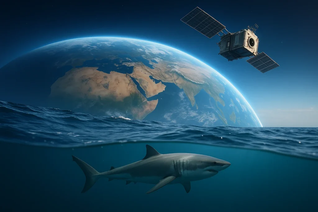
The idea of “shark spotting satellites” might conjure images of spacecraft directly peering through the ocean to find sharks. While that level of direct visual detection from space is still a distant dream for most marine life, the real magic lies in something equally remarkable: tiny, sophisticated devices called satellite tags. These tags are carefully attached to sharks by expert research teams, and they act as a vital link between the shark and the orbiting satellites above.
When a tagged shark surfaces – even for a brief moment – its tag sends a signal skyward to a constellation of satellites, such as the Argos system or Iridium. These satellites then relay the data back to ground stations, and from there, to researchers’ computers. This ingenious system allows scientists to map the movements of individual sharks over thousands of kilometers and across months or even years. It’s like giving each shark its own personal, ocean-spanning GPS tracker.
There are primarily two types of satellite tags commonly used:
- SPOT (Smart Position or Temperature Transmitting) Tags: These tags are usually attached to the shark’s dorsal fin. They transmit a signal whenever the fin breaks the water’s surface, providing near real-time location data. This is particularly useful for tracking sharks that spend time near the surface or in shallower coastal waters.
- PSAT (Pop-up Satellite Archival Tags): These tags are designed to detach from the shark after a programmed period (weeks or months) and float to the surface. Once at the surface, they transmit a summary of the data they’ve collected, which can include depth, temperature, and light levels, allowing scientists to reconstruct the shark’s journey and even estimate its location when it was deep underwater.
Mapping the Ocean’s Giants: Global Migration Patterns
Before satellite tagging became widespread, understanding shark migration was a painstaking and often incomplete process, relying on recapturing previously tagged sharks or anecdotal sightings. Now, with satellite data, the picture is becoming incredibly clear.
Organizations like OCEARCH, a non-profit marine research group, have revolutionized public engagement by openly sharing the real-time (or near real-time) tracks of tagged sharks on their online “Shark Tracker.” This allows anyone with an internet connection to follow the epic journeys of individual white sharks, tiger sharks, mako sharks, and more, as they traverse entire ocean basins.
These tracking efforts have unveiled astonishing migration patterns:
- Transoceanic Journeys: We now know that some sharks undertake incredible journeys, crossing vast stretches of open ocean. For example, great white sharks tracked off the coast of North America have been shown to travel to distant feeding grounds or breeding areas, sometimes covering thousands of miles in a single year.
- Seasonal Movements: Many species exhibit predictable seasonal migrations, moving between warmer and cooler waters, or between feeding and breeding grounds. Understanding these patterns is crucial for identifying critical habitats.
- Habitat Hotspots: The data helps pinpoint “hotspots” – specific areas that are vital for different life stages, such as nurseries where young sharks are born, feeding grounds rich in prey, or aggregation sites for mating.
This comprehensive mapping is transforming marine biology, providing the fundamental knowledge needed to protect these highly migratory species.
Protecting Both Sides: Swimmers and Sharks
One of the most compelling applications of satellite shark tracking is its potential to enhance both marine conservation and human safety. While the primary goal is scientific understanding, the data gathered can directly inform public safety initiatives, particularly in coastal areas.
- Localized Alerts: In regions prone to shark encounters, data from tagged sharks, especially those equipped with SPOT tags, can be integrated into public alert systems. For instance, the Sharktivity App in Massachusetts, powered by the Atlantic White Shark Conservancy, provides real-time information on confirmed white shark sightings and detections from tagged sharks, allowing beachgoers to make informed decisions.
- Behavioral Insights for Safety: By understanding when and why sharks move into certain areas (e.g., in response to prey availability, water temperature, or breeding cycles), authorities can issue more targeted warnings or adjust beach patrol strategies. This knowledge helps move away from fear-based reactions and towards data-driven prevention.
- Informing Conservation Measures: Knowing where sharks travel and what areas are critical for their survival allows conservationists to advocate for marine protected areas, sustainable fishing practices, and regulations that minimize human impact on shark populations. For example, tracking data can show if major shipping lanes or fishing grounds overlap with crucial shark migration corridors, leading to potential mitigation strategies. This shift towards understanding and proactive management benefits the entire marine ecosystem, contributing to healthy oceans that are safer for everyone.
Beyond the Surface: Diving Deeper into Data
Satellite tags aren’t just about location. Many sophisticated tags also collect environmental data, providing a much richer picture of the sharks’ world:
- Depth and Temperature: These sensors record how deep a shark dives and the water temperatures it experiences. This data helps scientists understand a shark’s preferred thermal habitats, its hunting strategies at different depths, and how it might respond to changes in ocean temperature due to climate change.
- Light Levels: PSAT tags often record light levels, which can be used to estimate a shark’s location even when it’s deep underwater and not directly communicating with satellites.
- Activity Patterns: Some advanced tags can infer activity levels, helping researchers understand when sharks are most active, resting, or feeding.
This wealth of information allows marine biologists to create detailed ecological profiles of different shark species, revealing their intricate roles within the ocean’s complex food webs. It helps us see sharks not just as mysterious predators, but as integral components of a healthy planet.
The Unseen Network: How Satellites Connect Us to the Deep
The capability to track marine animals globally relies on a remarkable unseen infrastructure: a network of dedicated scientific and communication satellites. Systems like Argos (Advanced Research and Global Observation Satellite) were initially developed for environmental monitoring and data collection from remote platforms. When a shark’s tag surfaces, it sends a brief burst of data to one of these orbiting satellites. As the satellite passes overhead, it picks up the signal and calculates the tag’s position based on the Doppler effect (changes in the signal’s frequency as the satellite approaches and recedes).
This data is then beamed down to ground receiving stations and made available to authorized researchers. This seamless, global relay system is what truly enables the long-distance, continuous tracking that was once impossible. It’s a testament to the power of international scientific collaboration and advanced space technology working in concert to unlock the secrets of our planet’s wild spaces.
Challenges and the Future Horizon
While satellite tracking has opened new doors, challenges remain in its application:
- Cost and Logistics: Tagging sharks is an expensive and logistically complex endeavor, requiring specialized vessels, equipment, and highly skilled teams to safely capture, tag, and release these large animals.
- Battery Life and Tag Retention: Tags have finite battery lives, and some can detach prematurely due to biofouling (marine growth) or physical abrasion, leading to gaps in tracking data.
- Data Gaps: Sharks spend a lot of time underwater, preventing tags from regularly communicating with satellites. This means data isn’t truly continuous for every second of a shark’s life, but rather a series of “pings” when it surfaces.
- Ethical Considerations: Researchers adhere to strict ethical guidelines to minimize stress and harm to the sharks during the tagging process, and ongoing research aims to develop even less intrusive methods.
Looking to the future, advancements in technology promise even greater insights. Smaller, more durable tags, longer battery lives, and more precise geolocation capabilities are constantly being developed. The integration of AI and machine learning could lead to even more sophisticated analysis of movement patterns, potentially even predicting behaviors. Furthermore, combining satellite tracking with other technologies like underwater acoustic receiver networks and drone surveillance will create an even more comprehensive picture of marine life.
A New Era of Ocean Stewardship
The advent of satellite shark tracking marks a new era in our relationship with the ocean. It’s a shift from perceiving sharks as mysterious, unknowable dangers to understanding them as complex, migratory creatures vital to marine health. By providing “eyes on the ocean,” these technologies empower us to:
- Conserve Smarter: Design more effective marine protected areas and fishing regulations that align with shark movements.
- Coexist Better: Improve public safety by understanding and anticipating shark behavior, leading to more informed and less fear-driven interactions.
- Educate and Inspire: Engage the public with the incredible journeys of individual sharks, fostering a deeper appreciation for marine life and the need for ocean conservation.
As satellites continue to orbit and sharks continue their ancient migrations, the data they share helps us write a new chapter in marine biology – one where technology and nature work hand-in-hand for a healthier, safer, and more understood ocean.


Can you be more specific about the content of your article? After reading it, I still have some doubts. Hope you can help me.
Your article helped me a lot, is there any more related content? Thanks! https://www.binance.bh/register?ref=QCGZMHR6