

Introduction: A Geographical Deception Etched in Stone and Ice
Centuries before the dawn of modern advertising, a geographical paradox was born in the North Atlantic, a tale of perception twisted by circumstance and ambition. It began with an exiled chieftain, scanning a colossal landmass shrouded in glacial blue, who had the audacity to christen it Greenland. Simultaneously, another island, a cradle of life with fjords and valleys of surprisingly lush fertility, was tragically branded Iceland by a settler struck by a moment of despair. This famous inversion of names—ice for green, and green for ice—is more than a historical footnote; it is a masterclass in ancient spin, an enduring saga that encapsulates the sheer power of human ingenuity over environmental reality.
The sheer scale of this Viking deception finds its modern context in the escalating climate crisis. The immense, glittering shield of the Greenland Ice Sheet, covering over 80% of the island, is a global thermometer. It holds a staggering volume of water, its complete melt having the theoretical potential to raise global sea levels by an alarming 7.4 meters (24 feet). This makes the territory named for its relative warmth a critical marker for the future of the entire planet. This comprehensive narrative explores the motivations of the Viking pioneers, the deep climatological truths behind the names, and the looming environmental future of these two remarkably mislabeled lands.
The story of these backward names represents one of history’s most successful and longest-lasting marketing campaigns, initiated by a Viking outlaw seeking to rebuild his life and legacy in an unknown land. What began as strategic deception has evolved into a permanent geographical label, creating an irony that has outlasted empires, survived climatic shifts, and continues to shape perceptions of these lands today. Understanding the true story behind these names requires journeying back to the Viking Age, a period of remarkable exploration and expansion that saw Norse seafarers venture across the North Atlantic.
The significance of this naming story extends far beyond historical curiosity. Today, as climate change accelerates, Greenland’s ice sheet and Iceland’s glaciers have become critical indicators of global environmental shifts. The very features that made their names ironic are now at the center of scientific research into rising sea levels, changing weather patterns, and the future of our planet. The Viking naming choices, made a millennium ago based on immediate practical concerns, have taken on new meaning in the context of contemporary climate science, connecting ancient history with pressing modern concerns.
The Viking World: Crucible of Exploration
To fully comprehend the circumstances that led to the paradoxical naming of Iceland and Greenland, we must first understand the Viking world that produced the explorers who discovered these lands. The Viking Age, spanning roughly from 793 to 1066 CE, was not merely an era of raiding and pillaging as commonly portrayed, but a period of extraordinary exploration, trade, and cultural expansion that stretched from North America to Central Asia.
The Vikings were master shipbuilders and navigators whose technological innovations enabled their remarkable journeys. Their longships, with their shallow drafts and flexible clinker-built construction, could navigate open oceans yet also sail up shallow rivers, making them ideal for both exploration and trade. These vessels, combined with sophisticated navigation techniques that used the sun, stars, wave patterns, and even the behavior of birds, allowed the Vikings to venture far beyond coastal waters into the unknown Atlantic.
Several interconnected factors drove the Viking expansion westward across the North Atlantic. Population pressure in Scandinavia, particularly in Norway, created land scarcity that pushed younger sons and ambitious families to seek new territories. The complex honor culture of Norse society, with its blood feuds and strict legal codes, often resulted in individuals being outlawed—banished from their communities—forcing them to seek new beginnings in unknown lands. A thirst for prestige, wealth, and adventure also motivated explorers to venture into uncharted waters.
The Viking expansion into the North Atlantic occurred during a climatic optimum known as the Medieval Warm Period (approximately 900-1300 CE). During this time, temperatures in the North Atlantic were 1-2°C warmer than in subsequent centuries, sea ice was less extensive, and growing seasons were longer. This temporary warming made settlement of northern lands more feasible than it would have been during colder periods. The Vikings were essentially exploring during a “sweet spot” in climate history that made harsh environments temporarily more hospitable.
Norse society was hierarchical and placed great importance on family reputation, honor, and wealth. The sagas—epic tales that blended history, mythology, and family stories—provide invaluable insights into the Viking worldview and the values that drove their explorations. These sagas, passed down orally for generations before being written down in the 12th and 13th centuries, contain our primary accounts of the discoveries and namings of Iceland and Greenland, offering a window into how the Vikings themselves understood these events.
The settlement pattern across the North Atlantic followed a stepping-stone approach. The Norse first settled the Shetland and Orkney Islands, then the Faroe Islands, then Iceland, then Greenland, and finally reached the coast of North America—a continent they called Vinland. Each settlement served as a base for further exploration, with information about new lands passing between communities through trade networks and family connections. This progressive exploration created the context in which Iceland and Greenland were discovered and named, with each island’s name reflecting the particular circumstances of its discovery and the intentions of its namers.
The Founding Father of Deception: The Epic of Erik the Red
The story of Greenland’s name is inextricably linked to the life of Erik Thorvaldsson, known to history as Erik the Red—a man whose fiery hair and temperament matched his memorable nickname. Erik’s personal history, marked by conflict, exile, and redemption, shaped his approach to naming the land he would help colonize. Understanding Erik’s background is essential to understanding why he chose to call an icy island “Greenland.”
Erik was born in Norway around 950 CE to Thorvald Asvaldsson, a man of some standing who found himself on the wrong side of the law. When Thorvald was convicted of manslaughter, he and his family were forced to flee Norway, joining the Norse settlement in Iceland. This early experience of exile—of being uprooted from home due to violence and legal judgment—would prove formative for the young Erik, establishing a pattern that would repeat throughout his life.
In Iceland, Erik married Thjodhild and established a farm at Haukadal. True to his nickname, Erik possessed a volatile temperament that frequently involved him in conflicts with neighbors. The crisis point came when Erik’s slaves accidentally caused a landslide that destroyed a neighboring farm owned by Valthjof. Valthjof’s friend, Eyjolf the Foul, killed the slaves in retaliation. Erik responded by killing Eyjolf and another man named Hrafn the Dueller.
This violence led to Erik being tried at the Thorsnes Thing, Iceland’s regional assembly. He was found guilty and sentenced to outlawry—banishment from Iceland for three years. This judgment meant that Erik could be killed with impunity if he remained in Iceland, forcing him to seek refuge elsewhere. It was this second exile that would lead to one of the most significant geographical discoveries—and namings—of the Viking Age.
Around 982 CE, Erik set sail westward from Iceland, heading toward a land that had been sighted decades earlier by another Viking explorer named Gunnbjörn Ulfsson. Gunnbjörn had been blown off course while sailing from Norway to Iceland and had reported seeing islands and a larger landmass further west. Erik decided to investigate these reports during his period of exile.
Erik’s journey took him across the Denmark Strait, a treacherous body of water separating Iceland from Greenland. He first encountered Greenland’s barren east coast, which was guarded by pack ice for much of the year. Not finding suitable landing places, he continued southward, eventually rounding Cape Farewell and discovering the more hospitable fjords of the southwest coast.
During his three years of exile, Erik explored Greenland’s coastline extensively, particularly focusing on the areas that would later become known as the Eastern and Western Settlements. He discovered that the southwestern region had relatively mild summers with green pastures suitable for grazing livestock—a crucial consideration for Norse farmers. The fjords teemed with fish, seals, and whales, while the land supported berries, grasses, and even small stands of dwarf birch and willow.
It’s important to recognize that Erik was viewing Greenland during the Medieval Warm Period, when temperatures in southern Greenland were approximately 1-2°C warmer than today. This climatic context made the region genuinely more hospitable than it would become in subsequent centuries during the Little Ice Age. The areas Erik explored were, in fact, greener and more capable of supporting Norse-style agriculture than they would be later, making his naming choice less deceptive in context than it might appear in hindsight.
When Erik’s exile ended in 985 CE, he returned to Iceland with a specific purpose: to recruit settlers for the new land he had explored. He faced a significant challenge—how to convince people to abandon their established farms in Iceland for an unknown and distant frontier? His solution represents one of history’s earliest and most successful examples of strategic naming and place marketing.
Erik deliberately named the land “Greenland,” later explaining (as recorded in the Saga of Erik the Red) that “people would be attracted to go there if it had a favorable name.” This naming strategy emphasized the positive aspects of the land—the summer greenery in the southern fjords—while downplaying the challenges of long, dark winters and the massive ice sheet that covered most of the interior. It was a brilliant piece of persuasive communication that framed the new land in the most appealing terms possible.
Erik’s marketing strategy proved remarkably successful. In 986 CE, he led a fleet of 25 ships carrying around 500 men, women, children, livestock, and supplies to Greenland. The journey was treacherous—only 14 ships completed the voyage, with the others turning back or being lost—but those that arrived established the Eastern and Western Settlements, which would endure for nearly 500 years. Erik himself established the estate of Brattahlíð in the Eastern Settlement, where he lived as a prominent chieftain until his death.
The success of Erik’s settlement expedition cemented the name “Greenland” in geographical terminology. Despite the increasing irony of the name as climates cooled during the Little Ice Age, the name persisted on maps and in geographical knowledge. Erik’s marketing ploy had created a permanent geographical label—one that would continue to confuse and fascinate people for more than a thousand years after his death.
The Traumatic Truth: How Despair Named Iceland
While the naming of Greenland owes itself largely to one man’s marketing strategy, the naming of Iceland has a more complex and gradual history involving multiple explorers and a longer process of discovery and settlement. The name that eventually stuck—Iceland—emerged from a combination of meteorological observations, personal experiences, and perhaps a desire to deter potential competitors.
The first Norse explorer to sight Iceland was likely Naddodd, a Viking who was blown off course around 860 CE while sailing from Norway to the Faroe Islands. Landing on the eastern coast of an unknown land, Naddodd climbed a mountain to look for signs of habitation but found none. As he prepared to depart, snow began to fall, prompting him to name the island “Snæland” (Snow Land). This name reflected his immediate experience of the land—a cold, snowy place apparently devoid of human inhabitants.
A few years after Naddodd’s discovery, a Swedish Viking named Garðar Svavarsson circumnavigated the island, determining that it was significantly larger than initially thought—in fact, the second-largest island in Europe after Great Britain. Garðar built a house and wintered on the island, which he named “Garðarshólmur” (Garðar’s Island) after himself. His reports noted that the land was covered with forests from mountain to shoreline—a stark contrast to the largely treeless landscape of modern Iceland, indicating significant environmental change over the centuries.
The name that ultimately endured came from Flóki Vilgerðarson, who set out deliberately to settle Garðarshólmur around 870 CE. Flóki’s expedition was ill-fated from the beginning. During the voyage, his daughter drowned in rough seas—a tragic start that colored his perception of the enterprise. Upon arrival, Flóki became so engrossed in fishing that he neglected to gather sufficient hay to feed his livestock through the winter.
The winter proved exceptionally harsh, and Flóki’s livestock perished from starvation and cold. When spring finally arrived, a frustrated and disappointed Flóki climbed a high mountain and looked out over a fjord still filled with icebergs—a common sight in Iceland’s northern waters even today. This view of ice-choked waters, combined with his personal misfortunes, inspired the name that would stick: “Ísland” or Iceland.
The irony of Flóki’s naming is that it contradicted the observations of one of his own crew members. While Flóki focused on the winter ice and his personal misfortunes, his companion Þórólfur reported that “butter dripped from every blade of grass” in Iceland—suggesting the land was incredibly fertile during summer months. This contradiction captures the essential duality of Iceland’s environment: harsh and challenging in winter, but abundantly productive in summer.
Despite its forbidding name, Iceland attracted settlers relatively quickly. The first permanent settler was Ingólfur Arnarson, who established his farm at Reykjavík (Smoky Bay) around 874 CE, naming it for the geothermal steam he observed—the same feature that now provides heating for most of Iceland’s population. According to tradition, Ingólfur used the Viking method of casting his high-seat pillars into the ocean and settling wherever they washed ashore.
The settlement of Iceland proceeded rapidly in what is known as the Landnám (Land-taking) period. Within about 60 years, most of the habitable areas had been claimed. The settlers found a land with extensive birch and willow forests, rich fishing grounds, and fertile volcanic soils. They established a sophisticated society that would eventually develop one of the world’s first parliamentary systems—the Althing, established in 930 CE at Thingvellir.
Why did the name “Iceland” persist despite the land’s evident summer greenery and fertility? Several factors may have contributed. The name accurately described the winter conditions that settlers had to endure. It may have served to deter potential competitors from seeking out this desirable territory. Or it may have simply stuck because it was memorable and distinctive. Whatever the reasons, the name endured, creating the perfect counterpart to Greenland’s misnomer and establishing one of geography’s most delightful ironies.
The Unseen Hand of Climate: Ocean Currents and Geologic Shifts
The apparent contradiction in the names of Iceland and Greenland becomes more understandable when we examine their actual climates, geographies, and how these have changed over time. Both islands are located in the North Atlantic, but they experience dramatically different environmental conditions due to their positions relative to ocean currents, sea ice, and atmospheric patterns. Understanding these physical realities helps explain why the names made sense to their Viking namers while becoming increasingly ironic over subsequent centuries.
Greenland’s Climate and Geography
Greenland is the world’s largest island, spanning over 2.1 million square kilometers (810,000 square miles)—though this figure is somewhat misleading, as much of this area is covered by the Greenland Ice Sheet. This massive ice sheet is second in size only to Antarctica’s, covering approximately 1.7 million square kilometers (656,000 square miles) and reaching thicknesses of over 3 kilometers (2 miles) at its center. The weight of the ice has depressed the bedrock beneath sea level in many areas, meaning that if the ice were removed, Greenland would appear as an archipelago rather than a single landmass.
The ice sheet creates its own weather patterns through its elevation and albedo (reflectivity). Cold air drains down its slopes, creating katabatic winds that can reach hurricane force near the coast. The ice sheet also influences regional climate by reflecting sunlight back into space, helping to maintain cold conditions in surrounding areas.
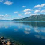
Despite its name, only the narrow coastal fringe of Greenland—representing about 16% of its total area—is ice-free. The ice-free areas are predominantly found along the coast, particularly in the southwest where the Norse settled. The southernmost parts of Greenland have a subarctic climate with temperatures that can reach 15-20°C (59-68°F) in summer but plunge to -30°C (-22°F) or lower in winter. Precipitation varies dramatically across the island, with the southeast coast receiving over 2,500 mm (98 inches) annually while the north gets as little as 200 mm (8 inches).
A critical factor in Greenland’s climate is the sea ice that surrounds much of the island for most of the year. This ice limited the Norse settlements to the southwestern coast and determined how long they could maintain contact with Iceland and Europe. The extent of sea ice has fluctuated over centuries, expanding during cold periods and contracting during warm ones, with significant implications for human settlement.
The Greenland Ice Sheet contains approximately 2.9 million cubic kilometers (696,000 cubic miles) of ice—enough to raise global sea levels by about 7.2 meters (24 feet) if it were to melt completely. While complete melting would take millennia under even the most extreme climate scenarios, the ice sheet is currently losing mass at an accelerating rate, contributing to sea-level rise and potentially disrupting ocean circulation patterns.
Iceland’s Climate and Geography
Iceland is considerably smaller than Greenland, covering about 103,000 square kilometers (40,000 square miles). Its climate is remarkably mild for its latitude, thanks largely to the North Atlantic Current, an extension of the Gulf Stream. This warm ocean current moderates Iceland’s temperatures, keeping winters significantly warmer than at similar latitudes elsewhere. Reykjavík, for example, has an average January temperature of 0°C (32°F), while locations at comparable latitudes in Greenland or Canada experience temperatures of -20°C (-4°F) or colder.
Iceland’s weather is famously variable, with the saying “if you don’t like the weather, wait five minutes” holding particular truth. The island sits at the convergence of Arctic and Atlantic air masses, leading to frequent storms and rapid weather changes. This variability results from Iceland’s position in the North Atlantic, where polar and tropical air masses meet, creating unstable atmospheric conditions.
About 11% of Iceland is covered by glaciers, the largest being Vatnajökull at 8,100 square kilometers (3,127 square miles). Unlike Greenland’s continental ice sheet, Iceland’s glaciers are mostly mountain ice caps. The combination of volcanic activity and glaciers creates unique landscapes where fire and ice literally meet, with volcanic eruptions sometimes occurring beneath ice caps, resulting in massive steam explosions and destructive glacial floods called jökulhlaups.
Iceland’s geological activity stems from its position astride the Mid-Atlantic Ridge, where the North American and Eurasian tectonic plates are pulling apart at a rate of about 2 centimeters per year. This geological setting results in frequent volcanic eruptions, geothermal activity, and earthquakes. There are over 200 volcanoes in Iceland, with eruptions occurring on average every 4-5 years. This volcanic activity has shaped Iceland’s landscape and provided resources like geothermal energy, but has also posed challenges to human settlement through volcanic eruptions and associated hazards.
The interaction between Iceland’s climate and geology creates a unique environment that supports distinctive ecosystems. Despite its name, Iceland has relatively lush vegetation during summer months, particularly in lowland areas. The original Viking settlers found forests of birch and willow covering about 25-40% of the island, though extensive deforestation occurred during the settlement period. Today, reforestation efforts are underway to restore some of Iceland’s woodland areas.
The Medieval Warm Period and Little Ice Age
The climate conditions the Vikings experienced when naming Iceland and Greenland were not static. The Medieval Warm Period (approximately 900-1300 CE) made both islands more hospitable than they are today or than they were during subsequent colder periods. Historical records and proxy data from ice cores, tree rings, and sediment samples indicate that during this time:
- Sea ice was less extensive, allowing for more reliable navigation between Iceland, Greenland, and Europe
- Growing seasons were longer in both Iceland and Greenland
- The tree line in Iceland was higher than today
- Greenland’s Norse settlements were able to practice agriculture more successfully
After 1300 CE, the climate began cooling, entering what scientists call the Little Ice Age, which lasted until about 1850. This cooling had devastating consequences for the Norse settlements in Greenland, as shorter growing seasons, increased sea ice, and stormier conditions made survival increasingly difficult. In Iceland, the Little Ice Age brought colder temperatures, glacier advance, and increased sea ice, making agriculture more challenging and leading to periods of famine.
The changing climate over the centuries amplified the irony of the names given to Iceland and Greenland. As Greenland became colder and icier during the Little Ice Age, its name seemed increasingly inappropriate. Meanwhile, Iceland’s climate, while challenged by the cooling, remained relatively moderate compared to Greenland, making its name seem equally mismatched. This climatic evolution turned what might have been minor historical curiosities into one of geography’s most striking paradoxes.
Norse Settlement in Greenland: Rise and Fall
The Norse colonies in Greenland represent one of history’s most remarkable examples of human adaptation to extreme environments. For almost 500 years, these settlements persisted at the edge of the habitable world, maintaining European culture and Christian religion in an Arctic landscape. The story of these settlements—their establishment, daily life, and eventual disappearance—provides crucial context for understanding the legacy of Erik the Red’s naming choice and how it evolved from practical description to historical irony.
Establishment of the Settlements
The Norse established two main settlement areas in Greenland:
- The Eastern Settlement (Eystribyggð): Located in what is now the Qaqortoq region, this was the larger and more southerly of the two, with approximately 4,000 inhabitants at its peak. This settlement included Erik the Red’s estate at Brattahlíð and eventually contained around 500 farms, 12 churches, a monastery, and a cathedral.
- The Western Settlement (Vestribyggð): Located near modern-day Nuuk, this settlement was smaller, with about 1,000 inhabitants and 90 farms. It was more vulnerable to climate change due to its northern position.
A smaller Middle Settlement existed between them, but was essentially an extension of the Eastern Settlement in terms of administration and culture.
The initial settlement in 986 CE established these communities as extensions of Icelandic Norse society. The settlers brought with them their language, customs, legal traditions, and domestic animals—cattle, sheep, goats, and pigs. They also brought the Christian religion, though the conversion of Greenland to Christianity appears to have been a gradual process completed in the 11th century.
Life in Norse Greenland
The Norse Greenlanders established an economy based on pastoral farming, supplemented by hunting and fishing. They raised livestock for meat, milk, and wool, and grew hay to feed their animals through the long winters. Their diet included dairy products, meat from their livestock, seals, walruses, whales, birds, and fish. They also hunted polar bears and traded their furs and ivory for goods that couldn’t be produced locally, such as iron, timber, and grain.
Archaeological excavations have revealed a sophisticated society with churches, monasteries, a cathedral (at Gardar), and even a bishopric established in 1126. The Greenland Norse maintained contact with Europe, exporting valuable commodities like walrus ivory, narwhal tusks (sold as “unicorn horns”), furs, and live polar bears for European royal menageries. In return, they imported wood, iron, church artifacts, and other luxury goods.
The settlement was technically under Norwegian sovereignty but largely self-governing. They adapted to their environment in creative ways, building houses with thick stone walls for insulation, and developing hunting techniques suited to the Arctic environment. They learned to hunt seals and walruses from boats, and evidence suggests they may have undertaken expeditions far to the north in search of valuable resources.
Despite their adaptations, the Norse Greenlanders maintained a distinctly European identity. They wore European-style clothing, used iron tools, and remained devout Christians. This cultural conservatism may have ultimately limited their ability to adapt when conditions deteriorated. Unlike the Inuit, who had a highly flexible culture optimized for Arctic survival, the Norse maintained their European lifestyle even as it became increasingly unsustainable.
The Mystery of the Disappearance
Sometime in the 15th century, the Norse settlements in Greenland vanished. The last written record of them is a marriage recorded in the Hvalsey Church in 1408. When European ships resumed regular visits to Greenland in the 16th century, they found only ruins. The disappearance of the Norse Greenlanders has fascinated historians and archaeologists for centuries, with multiple factors likely contributing to their demise:
- Climate change: The Little Ice Age made farming increasingly marginal, with shorter growing seasons and cooler summers reducing hay production essential for overwintering livestock.
- Economic changes: The value of walrus ivory declined with increased access to African elephant ivory, reducing Greenland’s economic viability.
- Contact interruption: Increased sea ice and storminess made travel to Europe more dangerous and less frequent, cutting off essential trade and communication.
- Conflict with Inuit: The Thule culture Inuit, better adapted to Arctic conditions, expanded into Norse areas, potentially leading to conflict or competition for resources.
- Environmental degradation: The Norse may have overgrazed their pastures and deforested the limited woodlands, leading to soil erosion and reduced productivity.
- Cultural inflexibility: The Norse maintained their European lifestyle rather than adopting more Arctic-adapted practices like the Inuit.
The fate of the Norse Greenlanders remains one of archaeology’s great mysteries. Some may have assimilated with Inuit groups, while others may have attempted to return to Iceland or Europe. Recent isotopic analysis of human remains suggests that some Norse may have adopted a more marine-based diet similar to the Inuit in their final years, indicating adaptation even as their society collapsed.
The disappearance of the Norse settlements marked the end of a remarkable experiment in Arctic European settlement. It also completed the transformation of Erik the Red’s naming strategy from practical marketing to historical irony. The “Green Land” had ultimately proven too hostile to maintain the society that named it, while Iceland, with its more moderate climate, continued to support its Norse-derived population. This divergent fate added another layer of irony to the names, demonstrating that the true nature of a land might ultimately matter more than its name.
The Evolution of Geographical Knowledge
As centuries passed following the Viking discoveries, European knowledge of the North Atlantic evolved, and with it, the perception of the names Iceland and Greenland. The ironic discrepancy between name and reality became increasingly apparent as geographical knowledge improved and climatic conditions changed. The story of how these names persisted on maps and in geographical understanding reveals much about the transmission of knowledge and the endurance of first impressions.
Medieval Cartography and Knowledge
During the Middle Ages, European knowledge of the North Atlantic was limited and often mixed with legend. Early maps, such as the Anglo-Saxon Cotton World Map (c. 1040), showed only vague conceptions of northern lands. As the Middle Ages progressed, Icelandic knowledge of Greenland and the North Atlantic was incorporated into European geographical understanding through contacts with Norway and other European kingdoms.
The Vinland Map, if genuine (which is highly doubtful), would represent early 15th-century knowledge of Norse discoveries in North America, including Greenland. More reliably, the Claudius Clavus map of 1427 showed a relatively accurate depiction of Greenland’s shape, though still connected to Europe. Medieval maps often placed mythical islands like Hy-Brasil or Frisland alongside real geographical features, reflecting the mixture of fact and legend that characterized geographical knowledge of the period.
The decline and eventual disappearance of the Norse Greenland settlements in the 15th century led to a reduction in direct European knowledge of Greenland. As contact was lost, Greenland became semi-legendary in European geography, sometimes appearing on maps as a promontory of Asia or as a separate but poorly understood landmass.
Renaissance and Age of Exploration
The Renaissance brought renewed interest in accurate cartography and geographical knowledge. Martin Waldseemüller’s 1507 world map, famous for being the first to use the name “America,” also depicted Greenland more accurately as an island. The Portuguese explorers João Fernandes Lavrador and Pêro de Barcelos visited Greenland around 1500, and their reports helped to reestablish it in European geographical consciousness.
The English explorer Martin Frobisher reached Baffin Island and Greenland in the 1570s during his search for the Northwest Passage. His expeditions brought back detailed descriptions of the Arctic environment, including the extensive ice coverage of Greenland. These accounts made it increasingly clear that Greenland was predominantly icy, while Iceland had significant green areas during summer.
During the 17th and 18th centuries, as whaling and fishing vessels increasingly operated in the North Atlantic, practical knowledge of the region grew. Detailed charts were produced for navigation, and the climates and environments of Iceland and Greenland became better understood among European mariners and geographers.
The Literary and Cultural Legacy
The naming irony has been noted by writers and thinkers for centuries. In Jonathan Swift’s 1726 novel Gulliver’s Travels, he includes a satirical passage about mapmakers who “place Greenland to the east of Canada, and Iceland to the west,” poking fun at geographical confusion while acknowledging the persistent irony of the names.
The 19th century saw growing scientific interest in the Arctic, with expeditions like Sir John Franklin’s ill-fated voyage to find the Northwest Passage. These expeditions brought back detailed descriptions of Greenland’s ice cap and Iceland’s volcanoes and geothermal features, further highlighting the naming paradox. The publication of the Icelandic sagas in modern translations during the 19th century also revived interest in the Viking discoveries and the origins of the names.
As geological and climatic sciences developed in the 19th and 20th centuries, researchers began to understand that the Viking names made more sense in the context of the Medieval Warm Period. The irony wasn’t just a historical curiosity—it was evidence of significant climate change over the centuries. This scientific understanding added depth to the naming story, connecting it to broader patterns of environmental history.
Modern Geographical Understanding
In the 20th and 21st centuries, with the advent of satellite imagery and advanced climate science, our understanding of Iceland and Greenland has become increasingly sophisticated. We can now precisely measure the extent of ice cover, monitor changes in glaciers, and understand the complex climatic factors that differentiate the two islands.
Despite this advanced knowledge, the names have persisted. They have become entrenched in geographical terminology, appearing on maps, in atlases, and in common usage worldwide. The irony of the names is now widely recognized, often serving as an introduction to the history of Viking exploration or to discussions of climate change.
The persistence of these names despite their inaccuracy demonstrates the enduring power of historical naming conventions. Once a name becomes established in geographical terminology, it tends to persist even when it no longer accurately describes the place. The names “Iceland” and “Greenland” have outlasted the Norse settlements, the Medieval Warm Period, the Little Ice Age, and the development of modern climate science, testifying to the enduring legacy of the Viking explorers who named them.
Greenland’s New Identity: The Fragile Sentinel of Global Warming
In the 21st century, Greenland has taken on new significance as a critical indicator of global climate change. The ice sheet that gave the island its ironic name is now melting at an accelerating rate, with profound implications for global sea levels and climate patterns. The story of Greenland’s name has become intertwined with contemporary environmental concerns, adding new layers of meaning to Erik the Red’s millennium-old marketing strategy.
The Science of the Greenland Ice Sheet
The Greenland Ice Sheet is a massive reservoir of frozen freshwater, containing approximately 2.9 million cubic kilometers (696,000 cubic miles) of ice. This represents about 8% of the world’s freshwater resources. If the ice sheet were to melt completely, global sea levels would rise by about 7.2 meters (24 feet). While complete melting would take centuries or even millennia under most climate scenarios, even partial melting has significant consequences for coastal communities worldwide.
The ice sheet is not a static feature—it gains mass through snowfall and loses mass through melting and calving of icebergs. In a stable climate, these processes would be roughly in balance. However, current warming trends have disrupted this balance, leading to net mass loss. Scientists monitor the ice sheet using a variety of methods:
- Satellite measurements: NASA’s GRACE and GRACE-FO missions have precisely measured changes in Earth’s gravity field to track mass loss from the ice sheet.
- Ice-penetrating radar: Aircraft equipped with radar systems map the thickness of the ice and the topography of the bedrock beneath.
- GPS stations: These measure how the bedrock rebounds as the weight of ice decreases—a process called isostatic adjustment.
- Ice cores: Cylinders of ice drilled from the ice sheet provide a history of past climate conditions, allowing scientists to contextualize current changes.
- Climate models: Computer simulations help scientists understand the processes driving ice loss and project future changes.
The data reveals an alarming trend: Greenland is losing ice at an accelerating rate. Between 1992 and 2018, Greenland lost approximately 3.8 trillion metric tons of ice, contributing about 10.6 millimeters to global sea-level rise. The rate of loss has increased significantly, from an average of 34 billion tons per year in the 1990s to 244 billion tons per year in the 2010s—a sevenfold increase.
Key Factors in Ice Sheet Melt
Several processes contribute to the accelerated melting of the Greenland Ice Sheet:
- Surface melting: Warmer air temperatures cause more extensive melting on the surface of the ice sheet. Meltwater can flow into the ocean or percolate through the ice, potentially lubricating the base and accelerating ice flow.
- Ice dynamics: Warmer ocean waters melt the fronts of marine-terminating glaciers, reducing their stability and allowing inland ice to flow more rapidly into the ocean.
- Albedo feedback: As the ice sheet melts, it exposes darker surfaces (rock, water, or aged ice) that absorb more solar radiation, leading to further warming and melting—a positive feedback loop.
- Atmospheric patterns: Changes in weather patterns, such as the persistence of high-pressure systems over Greenland, can lead to extended periods of warm, sunny weather that accelerate melting.
The interaction of these processes creates complex responses that make predicting future ice loss challenging. However, the overall trend is clear: Greenland is losing ice at an accelerating rate, and this loss is contributing significantly to global sea-level rise.
Recent Discoveries and Climate Implications
A startling discovery in 2017 highlighted the vulnerability of Greenland’s ice sheet. Scientists rediscovered an ice core that had been drilled at Camp Century, a secret U.S. military base, in 1966. Analysis of sediment at the bottom of the core revealed that much of Greenland was ice-free during a period of natural warming about 400,000 years ago, when global temperatures were similar to what we might experience in the near future.
This finding suggests that Greenland’s ice sheet is more sensitive to warming than previously thought. Current models indicate that we are already committed to significant sea-level rise from Greenland’s melting, even if we dramatically reduce greenhouse gas emissions. Some studies suggest that the ice sheet may have passed a tipping point, with annual snowfall no longer sufficient to replace ice lost through melting and calving.
The melting ice sheet is also affecting ocean circulation patterns. The influx of cold freshwater into the North Atlantic could potentially disrupt the Atlantic Meridional Overturning Circulation (AMOC), which includes the Gulf Stream. Such a disruption could have complex effects on weather patterns in Europe and North America, potentially leading to cooler temperatures in some regions even as the planet as a whole warms.
Societal and Geopolitical Implications
The changing climate in Greenland has significant implications for its population (approximately 56,000 people, mostly Inuit). While melting ice creates challenges, it also opens up new opportunities:
- Resource extraction: Melting ice may make mineral resources more accessible, though extraction poses environmental risks.
- Shipping: Reduced sea ice could open new shipping routes through the Northwest Passage.
- Agriculture: Warmer temperatures may allow expanded agriculture in southern Greenland, though soil limitations remain significant.
- Fishing: Changing ocean conditions are affecting fish stocks, creating both challenges and opportunities for Greenland’s fishing industry.
Geopolitically, Greenland’s strategic importance is increasing as the Arctic becomes more accessible. The United States, China, Russia, and other nations have shown growing interest in the region, leading to concerns about militarization and competition for resources.
The environmental changes in Greenland also have global implications through sea-level rise. Small island nations and coastal cities worldwide are vulnerable to even modest sea-level rise, making Greenland’s ice sheet a focus of international climate negotiations and adaptation planning.
The transformation of Greenland from a historical curiosity to a climate change bellwether represents a dramatic evolution in its significance. The name given by Erik the Red a millennium ago has taken on new meanings in the context of contemporary environmental challenges, connecting ancient history with pressing modern concerns.
Iceland in the Modern World: Fire, Ice, and Green Energy
While Greenland faces challenges from melting ice, Iceland has harnessed its unique geology to become a model of renewable energy use and environmental innovation. The country whose name emphasizes ice has become a world leader in geothermal energy, creating a modern irony that complements the historical naming paradox. Iceland’s story in the 21st century is one of successful adaptation to a challenging environment and thoughtful stewardship of natural resources.
Iceland’s Geological Activity
Iceland’s dramatic geology stems from its location astride the Mid-Atlantic Ridge, where the North American and Eurasian tectonic plates are pulling apart at a rate of about 2 centimeters per year. This geological setting makes Iceland one of the most volcanically active places on Earth, with over 200 volcanoes and an eruption occurring on average every 4-5 years.
The volcanic activity manifests in various forms:
- Fissure eruptions: Where lava erupts from elongated cracks in the Earth’s surface, such as the 2021 eruption at Fagradalsfjall.
- Subglacial eruptions: Occurring beneath ice caps, these can produce massive steam explosions and destructive glacial floods called jökulhlaups.
- Central volcano systems: Complex volcanic centers like Hekla and Katla that produce explosive eruptions.
This volcanic activity is complemented by extensive geothermal areas, where hot water and steam rise to the surface, creating hot springs, geysers, and mud pots. The English word “geyser” actually comes from Iceland’s Great Geysir, which gave its name to this hydrothermal phenomenon worldwide.
The combination of volcanic activity and glaciers creates unique landscapes where fire and ice meet. This dynamic environment has shaped Icelandic culture, influencing everything from settlement patterns to folklore to modern energy production.
Renewable Energy Leader
Iceland’s geological activity has enabled it to become a world leader in renewable energy. The country generates virtually 100% of its electricity from renewable sources—approximately 70% from hydropower and 30% from geothermal energy. This remarkable achievement is possible because of Iceland’s unique geology and relatively small population (about 370,000).
Geothermal energy plays a particularly important role in Icelandic life. About 90% of Icelandic homes are heated with geothermal energy, making fossil fuel heating largely unnecessary. Geothermal swimming pools are social hubs in communities across the country, and geothermal greenhouses allow year-round cultivation of vegetables in a challenging climate.
The Blue Lagoon, one of Iceland’s most famous tourist attractions, is actually fed by runoff from the Svartsengi geothermal power plant—a perfect example of turning an industrial byproduct into a recreational and tourist resource. This innovative approach exemplifies Iceland’s creative use of its geological resources.
Iceland’s success with renewable energy has made it a laboratory for clean technology. Researchers are exploring ways to export this expertise, particularly in geothermal energy, to other countries. Iceland has also experimented with using renewable electricity for energy-intensive industries like aluminum smelting, though this approach has generated controversy regarding its environmental benefits.
Climate Change Impacts in Iceland
Despite its green credentials, Iceland faces significant challenges from climate change. The country’s glaciers are retreating rapidly, with Okjökull glacier becoming the first to lose its glacier status in 2014. A plaque installed at the former glacier site memorializes it as the first Icelandic glacier lost to climate change and warns that “in the next 200 years, all our glaciers are expected to follow the same path.”
Glacial melt is causing the land to rebound—a process called isostatic adjustment—which is altering watersheds and affecting infrastructure. The reduction in ice cover is also changing albedo (reflectivity), causing Iceland to absorb more solar energy and potentially accelerate local warming. Additionally, melting glaciers are affecting volcanic activity by reducing pressure on magma chambers, potentially leading to increased eruptions.
Paradoxically, as Iceland’s ice diminishes, its name becomes increasingly ironic. Some have suggested renaming the country to reflect its volcanic nature or green summer landscapes, but the name has historical significance and is unlikely to change. Instead, Icelanders have embraced the irony, using it as a conversation starter about their country’s unique environment and history.
Tourism and Sustainable Development
Tourism has become a major industry in Iceland, with visitor numbers growing from about 500,000 annually in 2010 to over 2 million before the COVID-19 pandemic. This growth has brought economic benefits but also challenges related to environmental protection and infrastructure.
Iceland has responded by emphasizing sustainable tourism practices:
- The “Icelandic Pledge” asks visitors to travel responsibly and respect nature.
- Specific regulations protect sensitive areas from overuse.
- Infrastructure improvements aim to manage visitor flows while minimizing environmental impact.
The tourism industry often plays on the country’s name irony, with marketing materials highlighting the contrast between the icy name and Iceland’s dramatic landscapes of volcanoes, waterfalls, and green valleys. The slogan “Inspired by Iceland” emphasizes the country’s natural beauty and creative energy, turning the naming paradox into a marketing asset.
Cultural Preservation and Innovation
Iceland places strong emphasis on preserving its cultural heritage, particularly the Icelandic language, which has changed remarkably little since the Viking Age. Modern Icelanders can read the original sagas that tell the story of their settlement, creating a unique connection to their history. This linguistic continuity has helped preserve traditional place names and the stories behind them.
At the same time, Iceland has embraced innovation, particularly in using technology to manage its environment and resources. Advanced monitoring systems track volcanic activity, glacial changes, and weather patterns, helping to mitigate natural hazards. Renewable energy technology continues to advance, with research into deeper geothermal drilling and carbon capture and storage.
Iceland’s approach to balancing tradition and innovation, environmental protection and economic development, offers lessons for other nations facing similar challenges. The country whose name reflects its icy aspects has become a model of sustainability, demonstrating how societies can work with their environment rather than against it.
The Cultural Legacy: How Names Shape Perception
The names “Iceland” and “Greenland” have had a profound impact on how these lands are perceived by outsiders. This naming paradox offers fascinating insights into how language influences our understanding of places, and how first impressions—even misleading ones—can persist for centuries. The cultural legacy of these names extends beyond geography into tourism, literature, science communication, and even national identity.
Tourism and Marketing
The ironic names have become marketing tools for both countries, though they present different challenges and opportunities for their tourism industries.
Icelandic tourism campaigns often play on the contrast between the icy name and the country’s dramatic landscapes of volcanoes, waterfalls, and green valleys. The slogan “Inspired by Iceland” emphasizes the country’s natural beauty and creative energy, while subtly addressing the naming irony by showing that Iceland is much more than ice. Tourism materials frequently mention the naming story as an interesting historical anecdote that introduces visitors to Iceland’s Viking heritage.
Greenland’s tourism industry faces the opposite challenge—convincing potential visitors that there’s more to the country than ice. Marketing materials emphasize adventure tourism, Inuit culture, and the stunning beauty of the ice fjords and Northern Lights. The name “Greenland” is sometimes explained as reflecting the summer greenery in the south, but the focus is more on the unique Arctic experience than on justifying the name. Greenland’s tourism marketing tends to embrace the icy reality while highlighting cultural and adventure opportunities.
The different approaches reflect the distinct identities and attractions of each country. Iceland leverages its accessibility and diverse landscapes, while Greenland emphasizes its remote, pristine Arctic environment. Both, however, use the naming story as part of their cultural narrative, turning historical irony into a engaging story for visitors.
Indigenous Perspectives and Names
It’s important to note that the names “Iceland” and “Greenland” represent Norse/European perspectives. The Inuit people of Greenland call their country Kalaallit Nunaat, meaning “Land of the People.” This name reflects a very different relationship to the land—not as something to be marketed or claimed, but as home. The Inuit have inhabited Greenland for centuries, developing cultures and technologies finely adapted to the Arctic environment.
In recent decades, there has been growing recognition of Inuit perspectives in Greenland’s governance and cultural representation. The name Kalaallit Nunaat is used in official contexts alongside Greenland, and there is increasing emphasis on Inuit culture, language, and self-determination. This represents a reclaiming of indigenous identity after centuries of colonial influence.
In Iceland, while the Norse name has been fully adopted, there’s growing recognition of the need to preserve the Icelandic language in the face of globalization and tourism pressure. The language is remarkably similar to Old Norse, allowing Icelanders to read the original sagas that tell the story of their settlement. This linguistic continuity represents a deep connection to history that complements the naming story.
The coexistence of European and indigenous names and perspectives enriches our understanding of these lands, reminding us that places have multiple histories and meanings depending on who is telling the story.
Scientific Communication
The naming paradox has also affected how scientists communicate about climate change. The fact that Greenland is melting while having a “green” name creates a memorable hook for explaining complex climate science. Similarly, Iceland’s rapid glacial retreat provides dramatic visual evidence of warming trends.
Scientists studying these regions must often begin by addressing the naming irony before delving into their research. This has led to creative approaches to science communication that use the names as entry points for discussing broader environmental issues. For example:
- The contrast between Greenland’s name and its icy reality helps illustrate how climate conditions have changed since the Viking era.
- Iceland’s diminishing glaciers provide tangible examples of climate change impacts that are easily understood by non-specialists.
- The different responses of the two ice masses to climate change (Greenland’s massive ice sheet vs. Iceland’s smaller glaciers) help explain the variety of climate impacts.
The naming story has thus become a valuable tool for science communication, helping to make complex research more accessible and engaging to the public.
Literary and Popular Culture References
The Iceland-Greenland naming irony has been noted in literature for centuries. As mentioned earlier, Jonathan Swift referenced it in Gulliver’s Travels in the 18th century. In the 20th and 21st centuries, the paradox has appeared in everything from travel writing to science fiction to children’s books.
In popular culture, the naming story is often used as an example of historical irony or as an introduction to Viking history. It appears in trivia games, educational materials, and travel documentaries. The persistence of this story in popular consciousness demonstrates how geographical naming can capture the imagination and endure through cultural changes.
Some writers and artists have used the naming paradox as a metaphor for broader themes of perception versus reality, or the ways in which names and labels can shape our understanding of the world. This metaphorical use extends the significance of the naming story beyond geographical curiosity into philosophical reflection.
Educational Significance
The Iceland-Greenland naming story is a staple in geography education, often serving as an engaging introduction to topics like:
- The Viking Age and European exploration
- Climate change over historical timescales
- The relationship between human societies and their environments
- The power of names and perceptions
Teachers use the story to capture students’ interest before delving into more complex topics. The inherent irony makes it memorable, while the historical and scientific dimensions provide multiple avenues for further exploration.
The educational use of the naming story ensures that it will continue to be passed down to new generations, maintaining its place in our geographical imagination. It serves as a reminder that geography is not just about physical places, but about the stories we tell about those places and how those stories evolve over time.
Lessons from the Viking Naming Paradox
The story of how Iceland and Greenland got their names offers lessons that extend far beyond historical curiosity or geographical trivia. These lessons span multiple disciplines and themes, providing insights into human nature, environmental relationships, and the enduring power of language. Understanding these lessons helps us appreciate why this thousand-year-old naming story continues to resonate in the modern world.
The Power of Naming and First Impressions
Erik the Red’s marketing strategy demonstrates the enduring power of names to shape perception. His decision to call the icy island “Greenland” was a deliberate attempt to influence potential settlers’ perceptions and decisions. This strategy worked remarkably well, attracting enough settlers to establish communities that lasted for centuries.
The persistence of these names despite their inaccuracy shows how first impressions can become entrenched in language and knowledge systems. Once a name enters common usage, it tends to stick, even when subsequent information reveals it to be misleading. This phenomenon occurs not just with geographical names but with product names, brand names, and even personal names—the initial framing often outweighs later reality.
The naming story also illustrates how names can serve multiple purposes beyond simple description. Names can be marketing tools, political statements, expressions of hope or disappointment, or attempts to deter competitors. Understanding the motivations behind naming helps us decode the hidden messages and values embedded in the words we use for places.
Climate History and Human Adaptation
The Viking settlements in Greenland provide a compelling case study in human adaptation to climate change. The Norse successfully maintained a European society in the Arctic for nearly 500 years, but ultimately disappeared as conditions worsened during the Little Ice Age. Their story offers sobering lessons about the limits of adaptation and the importance of flexibility in the face of environmental change.
The different fates of the Icelandic and Greenlandic Norse settlements highlight how small differences in location and resources can lead to dramatically different outcomes. Iceland’s warmer waters and geothermal resources made it more resilient than Greenland during the Little Ice Age. This reminds us that environmental challenges affect different communities in different ways, depending on their specific circumstances and resources.
The climate history embedded in the naming story also shows that climate change is not just a modern phenomenon—human societies have always had to adapt to climatic variations. However, the current rate and scale of human-caused climate change present challenges that are unprecedented in human history, making the lessons from past adaptations both relevant and limited.
The Interconnectedness of Human and Natural Systems
The story of Iceland and Greenland reveals the deep connections between human societies and natural systems. Climate conditions enabled the Viking expansion during the Medieval Warm Period and contributed to the collapse of the Greenland settlements during the Little Ice Age. The names given to these lands reflected contemporary environmental conditions but persisted even as those conditions changed.
Today, human activities are influencing the climate of both islands through greenhouse gas emissions. The melting of Greenland’s ice sheet and Iceland’s glaciers is both a natural process and a human-accelerated phenomenon. This interconnectedness reminds us that we are not separate from nature but active participants in Earth’s systems.
The naming story thus becomes a metaphor for the complex relationship between human perception and environmental reality. We name places based on our understanding and intentions, but those places continue to evolve according to natural processes that may eventually make our names seem ironic or inappropriate. This dynamic relationship between language and landscape is ongoing, with climate change adding new layers of meaning to old names.
The Evolution of Knowledge and Perception
The history of how the names Iceland and Greenland have been understood over time illustrates the evolution of geographical knowledge and perception. As exploration, cartography, and science advanced, the irony of the names became increasingly apparent. What began as practical descriptions (in their specific historical context) became historical curiosities, and eventually symbols of environmental change.
This evolution shows how our understanding of places is not static but develops through accumulating knowledge and changing perspectives. It reminds us to be humble about our current understandings, which may seem limited or mistaken to future generations with different knowledge and values.
The naming story also illustrates how scientific understanding can enrich historical narratives. The realization that the Medieval Warm Period made Greenland genuinely greener when Erik named it added nuance to what might otherwise be seen as simple deception. Similarly, understanding the climatic differences between Iceland and Greenland helps explain why the names made sense to their namers while becoming increasingly ironic over time.
Lessons for Contemporary Issues
The lessons from the Viking naming paradox have relevance for contemporary issues:
- Environmental communication: The story shows how names and framing can influence public understanding of environmental issues. This insight is valuable for communicating about modern challenges like climate change.
- Sustainable development: The different adaptation strategies of Iceland and Greenland offer lessons for sustainable development in challenging environments.
- Cultural preservation: The persistence of indigenous names alongside European names highlights the importance of cultural diversity and preservation.
- Tourism management: The different tourism approaches in Iceland and Greenland show how places can leverage their unique histories and environments responsibly.
Perhaps the most important lesson is the value of looking beyond names to understand the complex realities they represent. The naming story encourages us to question first impressions, seek deeper understanding, and appreciate the dynamic relationships between language, culture, and environment.
Conclusion: The Enduring Legacy of a Viking Marketing Ploy
Over a thousand years after Erik the Red named Greenland to attract settlers, the irony of his marketing ploy continues to resonate. What began as a practical strategy for colonization has become a symbol of the complex relationship between human perception and environmental reality. The names “Iceland” and “Greenland” have outlasted the Norse settlements, the Medieval Warm Period, the Little Ice Age, and the rise of modern climate science. They continue to fascinate because they capture a fundamental human tendency—to see what we want to see, to emphasize the positive, and to shape reality through language.
The enduring appeal of the naming story lies in its multiple layers of meaning. On one level, it’s a simple tale of historical irony—a funny anecdote about how names can be misleading. On another level, it’s a window into the Viking Age, revealing the values, strategies, and worldviews of Norse explorers. On still another level, it’s a lesson in climate history, showing how environmental conditions have changed over centuries. And in the contemporary context, it’s a reminder of the profound environmental changes happening today and our role in shaping the future of places like Iceland and Greenland.
As we face the challenges of climate change in the 21st century, the stories of these two islands take on new significance. Greenland’s melting ice sheet reminds us of the profound changes underway in our climate system. Iceland’s successful harnessing of geothermal energy offers hope for a sustainable energy future. The names given to these lands a millennium ago connect us to past human experiences while urging us to consider our responsibility to future generations.
The Viking naming paradox ultimately teaches us that names are not just labels—they are stories we tell about places. These stories evolve over time, reflecting changing climates, expanding knowledge, and shifting cultural values. The names “Iceland” and “Greenland” will likely continue to spark curiosity and conversation for centuries to come, ensuring that Erik the Red’s marketing genius remains part of our geographical imagination long into the future.
In the end, the backward country names stand as a testament to human creativity, adaptability, and our enduring fascination with the places we call home—whether they be green lands dominated by ice, or icy lands that surprise us with their summer greenery. The paradox reminds us that reality is often more complex and interesting than our names for it, and that understanding any place requires looking beyond its label to appreciate its full story.
As the climate continues to change, the names may become even more ironic, or they may take on new meanings that we can’t yet anticipate. Whatever the future holds, the story of how Iceland and Greenland got their names will remain a compelling chapter in the long history of human interaction with the natural world—a reminder that the ways we name and understand our environment reflect both its reality and our hopes, fears, and aspirations placed upon it.
Unquestionably believe that which you said. Your favourite justification seemed to be on the internet the easiest thing to be mindful of. I say to you, I definitely get annoyed even as folks think about concerns that they just don’t realize about. You controlled to hit the nail upon the highest and also defined out the entire thing with no need side effect , other people can take a signal. Will likely be back to get more. Thank you
I love the efforts you have put in this, thank you for all the great articles.
I don’t think the title of your article matches the content lol. Just kidding, mainly because I had some doubts after reading the article. https://www.binance.info/register?ref=IXBIAFVY
Your point of view caught my eye and was very interesting. Thanks. I have a question for you. https://www.binance.info/register?ref=IHJUI7TF
Your article helped me a lot, is there any more related content? Thanks!
Can you be more specific about the content of your article? After reading it, I still have some doubts. Hope you can help me.