
An Expansive Journey Through Humanity’s Preferred Half of the Planet
Part One: The Big Picture
Chapter 1: A Tale of Two Hemispheres – Understanding the Basic Numbers
Imagine standing on a quiet beach in Ecuador, right where the equator cuts through the South American coast. You are standing on an invisible line that divides our entire world into two halves. If you take one step forward, you are in the Northern Hemisphere. One step back, and you are in the Southern Hemisphere. This line, which exists only in our minds and on our maps, separates humanity in a way that is more dramatic than almost any political border on Earth.
Let us sit with that thought for a moment. Of the roughly 8 billion people currently alive on this planet, nearly 90 percent are living their lives on the same side of that line, the northern side. That means about 6.57 billion individuals are going about their daily routines north of the equator, while only about 1.43 billion people call the southern half of our world home.
To truly grasp the scale of this imbalance, let us run some comparisons that make these numbers feel real. If you were to gather every person living in the Southern Hemisphere into one massive country, that country would still have fewer people than just two nations in the north, China and India combined. Think about that. The entire southern half of the planet, everyone in Australia, New Zealand, most of South America, southern Africa, and all the island nations below the equator, would fit inside China and India with room to spare.
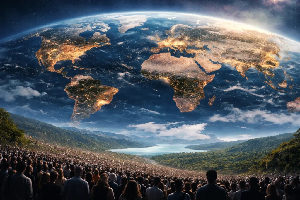
Picture a massive stadium that could hold all 8 billion people on Earth. In this imaginary stadium, the Northern Hemisphere would fill nearly every seat in the house, filling up nine out of every ten sections. The Southern Hemisphere would occupy just one small corner. If you walked through this stadium, you would pass crowd after crowd of people from the north, and you would eventually reach a relatively quiet section where the southerners sit.
This is not just a random curiosity that geographers like to mention at parties. This fundamental imbalance affects everything about our world. It shapes global politics, because the nations with the largest populations have the loudest voices in international affairs. It influences economics, because where people live is where markets grow and where industries develop. It determines cultural influence, because the stories, music, movies, and ideas that spread around the world most often come from regions with the most people to share them. It even affects the environment, because human activity is concentrated in specific bands of the planet, creating pressure on ecosystems in the north while leaving vast southern areas relatively untouched.
Consider for a moment the concept of the center of gravity for humanity. If you could calculate the average location of every single person on Earth, weighted by where they live, you would find that point somewhere in Central Asia or the Middle East, far north of the equator. The median human, the person right in the middle of our global population distribution, lives in the Northern Hemisphere. The average human, mathematically speaking, is northern.
This pattern has been building for tens of thousands of years. It did not happen by accident, and it is not changing quickly. To understand why our world is stacked this way, we need to go back to the very beginning and trace the long, winding path that brought us here. We need to understand the forces of geography, climate, history, and chance that have pulled humanity northward and kept us there.
Let us dig deeper into the numbers themselves. The figure of 6.57 billion people in the north is not just a statistic, it represents real human lives unfolding across an enormous variety of landscapes, cultures, and circumstances. In China alone, there are over 1.4 billion people, more than the entire population of the Southern Hemisphere. India adds another 1.4 billion. Together, these two nations account for more than a third of the global population, and both lie entirely north of the equator except for small parts of southern India that dip just below it.
The United States contributes about 330 million people, all in the north. Indonesia, the fourth most populous country, straddles the equator, with most of its people living north of it. Pakistan adds 240 million, Nigeria over 200 million, Bangladesh 170 million, Russia 145 million, Japan 125 million, Mexico 130 million, the Philippines 110 million, Egypt over 100 million, Ethiopia over 100 million, Vietnam nearly 100 million, and so on down the list. By the time you have counted all the northern countries, you have accounted for the vast majority of humanity.
Now consider the Southern Hemisphere. Brazil, the largest southern country, has about 213 million people. Indonesia’s southern regions add perhaps 100 million. The Democratic Republic of Congo has about 90 million, but only part of it is in the south. Tanzania has 60 million, South Africa 60 million, Argentina 45 million, Australia 26 million, and so on. The numbers dwindle quickly. Even if you add every country and territory south of the equator, you cannot reach even a quarter of the global total.
This imbalance becomes even more striking when you consider population density. The north not only has more people, it has more people packed into smaller spaces. The Ganges Plain in India has rural densities exceeding one thousand people per square kilometer. The Pearl River Delta in China has urban densities that boggle the mind. The Netherlands, a small northern country, has over four hundred people per square kilometer, making it one of the most densely populated nations on Earth. The southern hemisphere, by contrast, has vast empty spaces. The Australian Outback, the Patagonian steppe, the Kalahari Desert, the Amazon rainforest, these regions have fewer than one person per square kilometer over huge areas.
The northern squeeze is real, and it is measurable in every demographic statistic we have. But numbers alone cannot capture the full story. To understand why things are this way, we must look deeper, at the fundamental geography of our planet.
Chapter 2: The Geography of Life – Why Land and Climate Matter Most
Let us start with the most basic physical reality of our planet, the distribution of land and water. If you were an alien arriving in our solar system and you glanced at Earth from a distance, you might assume that any intelligent life that developed here would be evenly spread across the globe. After all, the planet is round, and it spins on its axis, so why would life spread out equally?
But a closer look at Earth reveals something crucial. The Northern Hemisphere holds approximately 68 percent of the planet’s landmass. That is nearly 40 million square miles of land above the equator, compared to only about 20 million square miles below it. This is not a small difference. It is a massive geographical advantage that has shaped the course of human history.
Think of it like a giant game of musical chairs, where land is the chairs and humans are the players. The Northern Hemisphere has twice as many chairs as the Southern Hemisphere. Even before we consider any other factors, the north simply has more room for people to live, farm, build cities, and raise families.
Now let us look at the actual continents. North America sits entirely in the Northern Hemisphere, a vast landmass stretching from the tropical waters of southern Mexico to the frozen islands of the Canadian Arctic. Europe is entirely northern, a peninsula of the larger Eurasian landmass that has been home to countless civilizations. Asia, the largest continent by far, is almost entirely northern, with only the island nations of Southeast Asia dipping below the equator. These three continents, North America, Europe, and Asia, form a connected supercontinent in the north, allowing for the movement of people, ideas, and goods across enormous distances.
The Southern Hemisphere, by contrast, is dominated by water. The Pacific Ocean, the largest feature on our planet, spreads across the southern half of the globe like a massive blue blanket. The Indian Ocean covers another huge swath. The Southern Ocean encircles Antarctica. The southern continents are smaller and more isolated. South America extends a long finger down from the equator, but its southern half narrows dramatically. Africa straddles the equator, with about two-thirds of its landmass in the north and one-third in the south. Australia sits alone, an island continent separated from the rest of the world by vast oceans. Antarctica is a frozen desert at the bottom of the world, nearly uninhabitable.
But land area alone does not tell the whole story. It is not just about having land, it is about having land that humans can actually use. This brings us to the concept of climate zones and habitability.
The equator itself receives the most direct sunlight year-round, creating tropical climates that are warm and wet. While these regions are incredibly biodiverse, they present serious challenges for human habitation on a large scale. Tropical rainforests, like the Amazon in South America and the Congo Basin in Africa, have poor soils for agriculture. The heavy rains leach nutrients from the ground, making it difficult to farm the same land for many years. The humidity and warmth also create ideal conditions for diseases like malaria, dengue fever, and sleeping sickness, which have historically limited population densities. The dense vegetation makes travel and communication difficult, keeping communities small and isolated.
As you move away from the equator toward the poles, you encounter temperate zones. These regions, found between the tropics and the polar circles, have four distinct seasons, moderate temperatures, and reliable rainfall patterns. The soils in many temperate regions are rich and fertile, built up over thousands of years of natural processes. These are the lands where agriculture flourished, where civilizations grew, and where large populations could be sustained.
The Northern Hemisphere has a vast temperate zone stretching across North America, Europe, and Asia. This zone includes the Great Plains of the United States and Canada, the farmlands of France and Germany, the breadbasket of Ukraine, and the fertile river valleys of China and India. These regions have been the breadbaskets of humanity for thousands of years.
The Southern Hemisphere has temperate zones too, but they are much smaller. The southern cone of South America, including Argentina and Chile, has temperate grasslands called the Pampas. Southern Africa has a temperate tip around Cape Town. New Zealand and southeastern Australia have temperate climates. But these regions are fragments compared to the vast temperate expanses of the north.
Then there are the polar regions. The Arctic in the north has land, northern Canada, Alaska, Greenland, Siberia, but it is covered in ice and permafrost, with short, cold growing seasons that make traditional agriculture impossible. These areas remain nearly empty. Antarctica, in the south, is even more extreme, a continent covered in ice miles thick, with no permanent human population at all.
So the geographical reality is clear, the Northern Hemisphere got more land, and most of that land falls within climate zones that are favorable to human life. This was not a matter of luck or chance. It is simply how the continents drifted over millions of years of geological time. But for humans, who evolved relatively recently, this ancient geography created the stage upon which our entire story would unfold.
Let us explore this geographical advantage in more detail. The Eurasian landmass, the largest continuous landmass on Earth, stretches from the Atlantic Ocean to the Pacific Ocean, covering about 21 million square miles. It is home to dozens of major river systems, including the Rhine, Danube, Volga, Indus, Ganges, Yangtze, Yellow, and many others. These rivers provided water for irrigation, transportation routes for trade, and fertile floodplains for agriculture. The east-west orientation of Eurasia meant that crops, animals, and technologies could spread relatively easily along similar latitudes, from China to Europe and back again.
North America, while smaller than Eurasia, still offers about 9.5 million square miles of land, with major river systems like the Mississippi, Missouri, and St. Lawrence, and vast interior plains perfect for agriculture. The continent’s north-south orientation did pose some challenges for the spread of agriculture, but the sheer size and fertility of the land compensated.
Now contrast this with the southern continents. South America has about 6.8 million square miles, but much of it is covered by the Amazon rainforest or the Andes Mountains. The continent’s north-south orientation meant that crops and animals domesticated in one latitude could not easily spread to others. Potatoes, domesticated in the high Andes, did not thrive in the lowland tropics. Maize, developed in Mesoamerica, spread slowly into South America.
Africa, south of the Sahara, has about 9 million square miles, but the continent’s shape works against it. The widest part of Africa is in the north, with the southern half tapering to a point. The Congo Basin, a massive area of tropical rainforest, is difficult to traverse and farm. The Kalahari and Namib deserts cover huge areas in the southwest. The Great Rift Valley, while beautiful, creates fragmented landscapes. And throughout much of sub-Saharan Africa, the tsetse fly made animal husbandry nearly impossible, depriving farmers of draft animals and manure for fertilizer.
Australia, at 3 million square miles, is the smallest continent and the driest inhabited one. Most of its interior receives too little rainfall for agriculture. The fertile coastal fringe, where most Australians live, is a narrow ribbon around the edge of a vast, arid interior.
The geographical advantage of the north is not just about total land area, it is about the quality and connectivity of that land. The north has more fertile soil, more navigable rivers, more temperate climate, and more east-west connectivity. These factors combined to create conditions favorable for the development of agriculture, the growth of populations, and the rise of civilizations.
Chapter 3: Walking Out of Africa – The Ancient Human Journey Northward
Every human alive today, whether they live in New York City or a small village in Kenya, whether they have pale skin and blue eyes or dark skin and brown eyes, shares a common origin. Our species, Homo sapiens, evolved in Africa. The earliest fossils of anatomically modern humans have been found in Ethiopia and date back around 300,000 years. For the vast majority of our time on this planet, all humans lived in Africa.
Picture Africa 100,000 years ago. Small bands of hunter-gatherers roam the savannas and woodlands, following the herds of animals and gathering wild plants. They know their territories intimately, where to find water during the dry season, which plants are safe to eat, where the best flint for toolmaking can be found. Their world is small, measured in days of walking. They have no idea that there is a whole planet beyond their horizons.
But change was coming. The climate of Africa has never been stable. Over tens of thousands of years, it has swung between wet periods, when the Sahara Desert was green and covered with lakes and grasslands, and dry periods, when the desert expanded and resources became scarce. During these dry periods, competition for food and water would have intensified. Groups would have been forced to range farther in search of resources.
The first movements out of Africa probably happened along the coastline. The Arabian Peninsula, just across a narrow strait from the Horn of Africa, would have been visible on clear days. At times of low sea level, when much of Earth’s water was locked up in glaciers, the crossing would have been even easier. Small groups of explorers, probably following familiar prey animals or searching for new shellfish beds, would have made the crossing.
This was the beginning of the great northern migration. Once humans crossed into Arabia, they were in the Northern Hemisphere. They had left the continent of their birth and entered a new world. From there, the path of least resistance led northward along the fertile coastal plains of the Persian Gulf region and into the Middle East.
Imagine being among those first explorers. You do not know you are leaving your homeland forever. You are just following the food, following the water, following the seasons. The land ahead looks promising, green valleys, abundant game, rivers full of fish. The land behind you is becoming more crowded, more competitive. So you keep moving, generation after generation, slowly pushing into new territories.
The Middle East, particularly the region known as the Levant, became a crucial crossroads. Here, humans found a land of hills and valleys, with Mediterranean climates and diverse resources. Archaeological sites in Israel, such as Skhul and Qafzeh, show that modern humans had reached this region by at least 120,000 years ago. They were not just passing through, they were settling, at least temporarily.
From the Middle East, the migration routes split. One branch headed westward, following the Mediterranean coastline into Europe. This was a slower process, because Europe was already occupied by another human species, the Neanderthals. These cousins of ours had lived in Europe for hundreds of thousands of years and were well adapted to the cold conditions. Modern humans and Neanderthals would have encountered each other, competed for resources, and sometimes interbred. But over time, modern humans proved more adaptable, and Neanderthals gradually disappeared.
Another branch headed eastward, across the vast grasslands of Central Asia. These were tough people, adapted to following herds across enormous distances. They spread across Siberia, learning to survive in some of the coldest environments on Earth outside the polar regions. They made clothing from animal hides, built shelters from bones and skins, and developed hunting techniques for mammoths and other large game.
The final leg of this ancient journey was perhaps the most dramatic. During the last ice age, when sea levels were much lower, a land bridge connected Siberia to Alaska across what is now the Bering Strait. This region, called Beringia, was a vast grassland steppe, home to herds of mammoths, bison, and horses. Hunter-gatherers followed these herds across the land bridge, probably without realizing they were entering an entirely new continent.
From Alaska, small bands of pioneers spread southward, through ice-free corridors along the Rocky Mountains or down the Pacific coast. Within a few thousand years, humans had reached the tip of South America. The entire hemisphere had been populated, from the Arctic to the Antarctic, by people whose ancestors had started in Africa.
This ancient migration story is crucial for understanding modern population patterns. By the time humans had spread across the globe, the seeds of our future population distribution had already been planted. The northern continents, Europe, Asia, and North America, were populated. The great population centers of the future were being established, and they were overwhelmingly in the north.
But why did not the population of the Southern Hemisphere grow to match the north? After all, South America was populated relatively quickly, and Africa still had its original population. The answer lies in what happened next, the invention of agriculture and the revolutionary changes it brought to human society.
Let us follow one possible migration path in more detail. Imagine a small band of perhaps thirty people moving slowly along the coast of the Arabian Peninsula. They have no destination in mind, only a constant search for food and water. They know the tides and the seasons, where to find shellfish, where to find fresh water seeping from the cliffs. They carry their few possessions, stone tools, fire-making kits, animal-skin bags. Children are born along the way, elders die and are buried. The band splits when it gets too large, one group staying put, another pushing onward.
Over generations, this slow movement carries them thousands of miles. They reach the head of the Persian Gulf, where the rivers Tigris and Euphrates empty into the sea. The land here is rich, with marshes full of fish and birds, with plains covered in wild grains. Some groups settle here, becoming the first inhabitants of Mesopotamia. Others continue north and west, into the hills of what is now Turkey and Syria.
Meanwhile, other bands have taken different routes. Some went south along the coast of Africa, reaching the Cape of Good Hope. Some went inland, following rivers into the heart of the continent. Some crossed into Europe across the Bosporus, when sea levels were low enough. Some pushed east into the vastness of Asia, across the steppes and through the mountain passes.
Each of these migrations was a story of survival, of adaptation, of human ingenuity. The people who moved into cold climates learned to make warm clothing and shelter. Those who moved into forests developed new hunting techniques. Those who stayed near coasts continued to rely on marine resources. Every environment presented challenges, and humans met them with creativity and determination.
But the environments themselves were not equal. The northern continents offered more land, more resources, more opportunities for population growth. The southern continents, while rich in their own ways, presented more obstacles and offered fewer rewards. This difference would become increasingly important as humans learned to farm.
Chapter 4: Sowing the Seeds of the North – How Farming Changed Everything
For the vast majority of human history, about 95 percent of our time on Earth, everyone was a hunter-gatherer. People lived in small, mobile bands, moving with the seasons and the movements of animals. They had deep knowledge of their environments and sophisticated technologies for hunting and gathering. But they did not farm. They did not settle in permanent villages. They did not build cities.
Then, around 12,000 years ago, everything changed. In several parts of the world, independently and at roughly the same time, humans began to domesticate plants and animals. They learned to plant seeds, tend crops, and harvest the results. They learned to breed wild animals for tameness and utility. This was the Agricultural Revolution, and it was the single most transformative event in human history.
The first and most important center of agricultural development was the Fertile Crescent, a crescent-shaped region stretching from the eastern Mediterranean coast through modern-day Syria and Iraq and down to the Persian Gulf. This region, located entirely in the Northern Hemisphere, had an extraordinary combination of resources. It was home to wild ancestors of some of our most important crops, wheat, barley, lentils, peas, and chickpeas. It was also home to wild ancestors of major domesticated animals, goats, sheep, pigs, and cattle.
Imagine the first farmers. They were not trying to invent agriculture. They were probably just trying to make their lives a little easier. Perhaps they noticed that seeds dropped near their camps would sprout the next season. Perhaps they began to clear competing plants from areas where wild grains grew densely. Gradually, over generations, they selected plants with desirable traits, larger seeds, seeds that stayed on the stalk longer, seeds that were easier to harvest. They were changing the plants, and the plants were changing them.
Farming required people to stay in one place. You could not follow the herds if you had planted fields that needed tending. So villages formed. People built more permanent shelters. They developed storage technologies, pots, baskets, granaries, to keep their harvests safe. They began to accumulate possessions in ways that hunter-gatherers never had.
The population implications were enormous. A given piece of land could support many more farmers than hunter-gatherers. Estimates vary, but a general rule of thumb is that farming can support ten to one hundred times more people per square mile than hunting and gathering. This meant that as agriculture spread, populations exploded.
From the Fertile Crescent, farming spread in waves. It spread westward into Europe, carried by migrating farmers who gradually replaced or mixed with the existing hunter-gatherer populations. It spread eastward into the Indus Valley and beyond. It spread southward into Africa, though more slowly due to the barrier of the Sahara Desert.
Other centers of independent agricultural development emerged, all in the Northern Hemisphere. In China, people domesticated rice and millet along the Yellow and Yangtze Rivers. In Mesoamerica, people domesticated maize, beans, and squash. In the eastern United States, a smaller agricultural complex developed around sunflowers and other native plants. In each case, the pattern was the same, farming led to villages, villages led to larger populations, and larger populations led to more complex societies.
The Southern Hemisphere had its own agricultural developments, but they were later and more limited. In the Andes of South America, people domesticated potatoes, quinoa, and llamas. In New Guinea, there was early development of agriculture based on taro and bananas. But these developments did not spread as widely or support populations as large as the northern agricultural complexes. The reasons were partly environmental and partly historical. The southern continents had fewer domesticable plants and animals. They were more isolated from each other, limiting the exchange of crops and technologies. And they were smaller, with less land suitable for intensive agriculture.
By the time farming was well established, the demographic die was cast. The Northern Hemisphere had a massive head start in population that would only grow over time. The great population centers of the future, the river valleys of China, India, the Middle East, and Europe, were already filling up with farmers and their descendants.
Let us explore the Fertile Crescent in more detail. This region, sometimes called the Cradle of Civilization, is where the first farmers transformed human society. The hills of eastern Turkey and northern Iraq are covered with wild wheat and barley. The mountains of Iran and Iraq are home to wild goats and sheep. The river valleys below provided water and rich soil. All the ingredients for agriculture were present in one place.
The first farmers did not immediately give up hunting and gathering. They probably mixed both strategies, hunting when game was available, gathering wild plants when they were in season, and tending small garden plots near their camps. Over time, as the gardens became more productive and reliable, they spent more time farming and less time hunting. Eventually, some groups became full-time farmers, living in permanent villages and relying almost entirely on their crops and domesticated animals.
The first farming villages were small, perhaps a few dozen families living in mud-brick houses clustered together for protection. They stored their harvests in communal granaries. They made pottery to cook and store food. They traded with neighboring villages for stone, salt, and other goods. They buried their dead beneath the floors of their houses, keeping their ancestors close.
As farming techniques improved, villages grew larger. By 7000 BCE, there were towns with thousands of people. Çatalhöyük in modern Turkey was one such place, with perhaps 8,000 residents living in houses packed together like honeycombs. People entered their homes through holes in the roofs, climbing down ladders. They painted their walls with scenes of hunting and ritual. They buried their dead beneath the platforms where they slept.
These early farming communities were the foundation upon which all later civilizations were built. They developed the technologies, the social structures, and the cultural practices that would shape human society for millennia. And they were all in the Northern Hemisphere.
Chapter 5: The River Valley Civilizations – Cradles of Population Density
With farming came the ability to produce surplus food. A single farmer could grow enough grain to feed their family and several other people. This surplus freed some people from the need to produce their own food. They could become specialists, potters who made containers for storage and cooking, weavers who made cloth, toolmakers who crafted better plows and weapons, builders who constructed more impressive buildings.
These specialists tended to cluster together, forming towns and then cities. And the first great cities arose in the river valleys that had the richest soils and most reliable water supplies. All of them were in the Northern Hemisphere.
Let us take a journey through these early population centers, because understanding them helps us understand where our modern population clusters came from.
Mesopotamia: The Land Between Rivers
Between the Tigris and Euphrates Rivers in modern-day Iraq, the world’s first cities emerged around 4000 BCE. The Greeks called this region Mesopotamia, meaning between the rivers. Here, the annual floods deposited rich silt on the fields, keeping them fertile year after year. The rivers provided water for irrigation, allowing farming to expand beyond the narrow floodplains.
Cities like Uruk, Ur, and Babylon grew to unprecedented sizes. Uruk, at its height around 2900 BCE, may have had 50,000 to 80,000 residents, more people than had ever lived in one place before. These cities were centers of administration, religion, and trade. They developed the first writing systems, first recorded laws, first monumental architecture. The population density of Mesopotamia was unlike anything the world had seen.
The Mesopotamians faced challenges that would become familiar to later civilizations. The rivers that gave them life also brought destructive floods. The soil, while fertile, could become waterlogged and salty if over-irrigated. Cities fought over water rights and land. But they also created remarkable solutions. They built canals to control flooding and distribute water. They developed systems of fallowing to maintain soil fertility. They created laws to govern water use and resolve disputes.
The population of Mesopotamia grew steadily. By 2000 BCE, the region may have had over a million people, concentrated in dozens of cities and hundreds of villages. This density of population created new social dynamics. People who had never met each other had to learn to live together in close quarters. New forms of governance emerged to manage the complexity. Kings, priests, bureaucrats, and soldiers became part of everyday life.
Ancient Egypt: The Gift of the Nile
The Greek historian Herodotus called Egypt the gift of the Nile, and he was right. Without the Nile River, Egypt would be just another stretch of desert. But the Nile flooded predictably every year, depositing fertile silt on its banks and creating a narrow ribbon of green through the brown landscape.
Egyptian civilization developed along this ribbon, with cities and towns strung along the river like beads on a string. The population was concentrated in the Nile Valley and Delta, one of the most densely populated agricultural regions in the ancient world. At its peak, ancient Egypt may have had three to four million people, all living within a few miles of the river.
The Nile was not just a water source, it was a highway. Boats carried people and goods up and down the river, connecting Upper Egypt in the south with Lower Egypt in the north. This internal connectivity allowed for political unification and cultural cohesion, further supporting population growth.
Egyptian civilization was remarkably stable. For nearly three thousand years, pharaohs ruled over a society that changed slowly. The annual flood of the Nile was so reliable that the Egyptians based their calendar on it. They developed advanced mathematics to survey land after the floods, astronomy to predict the floods, and engineering to build monuments that still stand today.
The population of Egypt was concentrated in a narrow strip. From Aswan in the south to the Mediterranean in the north, the Nile Valley is only a few miles wide. Beyond the valley, on either side, lies desert. This geography concentrated people in a linear pattern, with towns spaced every few miles along the river. Even today, more than 90 percent of Egypt’s population lives on less than 5 percent of its land, the Nile Valley and Delta.
The Indus Valley Civilization
While Egypt and Mesopotamia were flourishing, another great civilization arose along the Indus River in modern-day Pakistan and western India. Cities like Mohenjo-Daro and Harappa were carefully planned, with grid layouts, advanced drainage systems, and standardized brick sizes. At its height, the Indus Valley Civilization may have covered an area larger than either Egypt or Mesopotamia and supported a population in the hundreds of thousands.
The Indus Valley had rich alluvial soils and reliable water from the river and its tributaries. The civilization engaged in extensive trade with Mesopotamia, showing that these early population centers were connected across vast distances. The seeds of South Asia’s future population density were being sown.
What makes the Indus Valley Civilization remarkable is its consistency. Across hundreds of miles, cities were built to similar plans, using standardized bricks. Weights and measures were uniform. This suggests a level of organization and control that is impressive even by modern standards. The civilization lasted for nearly a thousand years, from about 2600 to 1700 BCE, before declining for reasons that are still debated.
The population of the Indus Valley was concentrated in cities and towns, but also spread across the countryside in farming villages. The region’s fertility, combined with its sophisticated water management, allowed for dense settlement. When the civilization declined, the population did not disappear, it dispersed, contributing to the later population of the Indian subcontinent.
Ancient China: Along the Yellow River
In East Asia, Chinese civilization emerged along the Yellow River, known in Chinese as Huang He. The river’s name comes from the yellow silt it carries, which also enriches the surrounding plains. Here, people domesticated millet in the north and rice in the south, creating two complementary agricultural systems.
The Shang and Zhou dynasties built cities and expanded Chinese control over the river valleys. By 1000 BCE, the population of China may have rivaled that of the entire Mediterranean region. The pattern of dense settlement along rivers, supported by intensive agriculture, was firmly established and would continue for millennia.
Chinese civilization developed in relative isolation from the west. The Himalayas, the Tibetan Plateau, and the vast deserts of Central Asia created barriers that limited contact. This isolation allowed Chinese culture to develop distinctive characteristics, a writing system based on characters rather than an alphabet, a philosophy focused on harmony and hierarchy, a political system centered on the emperor as the Son of Heaven.
The Yellow River, while life-giving, was also unpredictable and dangerous. Its floods could be catastrophic, earning it the nickname China’s Sorrow. The Chinese responded by building ever more elaborate systems of dikes and canals to control the river. These massive public works required organization on a scale that only a centralized state could provide, reinforcing the power of the emperor and his bureaucracy.
The population of China grew steadily. By the Han Dynasty, around 200 CE, China may have had 60 million people, comparable to the Roman Empire at its peak. The rice paddies of the south, which could support more people per acre than the wheat fields of the north, were being developed. The foundations of China’s future demographic dominance were being laid.
These river valley civilizations were not just population centers, they were engines of innovation. Writing, mathematics, astronomy, law, organized religion, and centralized government all developed in these densely populated regions. Each innovation made society more complex and capable of supporting even larger populations.
Meanwhile, what was happening in the Southern Hemisphere? In South America, civilizations were also developing, but later and on a smaller scale. The Norte Chico civilization in coastal Peru, dating to around 3000 BCE, built impressive cities and traded along the coast. Later, the Chavin and Moche cultures would flourish in the Andes. But the population densities never reached the levels of the Old World river valleys. The combination of challenging geography, limited domesticable crops, and isolation kept populations smaller.
In Africa south of the Sahara, complex societies were developing as well, particularly in the Sahel region south of the desert and in the highlands of Ethiopia. But again, the tsetse fly prevented the use of animal power in agriculture, and the lack of domesticable grains comparable to wheat and barley limited productivity. Populations grew, but not at the same explosive rates as in the north.
By the time of the Roman Empire, the demographic pattern of the world was already clear. The Northern Hemisphere, from the Mediterranean to China, was dotted with cities and dense agricultural populations. The Southern Hemisphere, while inhabited, remained comparatively empty.
Chapter 6: The Great Empires of the North – Building Population Centers
As civilizations grew, they began to expand beyond their original river valleys. They conquered neighboring territories, absorbed other peoples, and built empires that stretched across continents. These empires, all based in the Northern Hemisphere, further concentrated population and power in the north.
The Persian Empire
At its height around 500 BCE, the Persian Empire stretched from India to southeastern Europe, encompassing millions of people. The Persians built roads, standardized weights and measures, and created administrative systems that allowed for the efficient management of their vast territories. This stability encouraged trade and population growth across a huge area of the Northern Hemisphere.
The Persian Empire was remarkable for its tolerance and organization. Conquered peoples were allowed to keep their own religions, laws, and customs, as long as they paid tribute and remained loyal. This created a stable environment in which populations could grow and economies could flourish. The Royal Road, stretching from Susa in Persia to Sardis in Anatolia, allowed messengers to travel from one end of the empire to the other in just over a week. Trade goods, ideas, and people moved along this network, connecting distant regions.
The population of the Persian Empire is difficult to estimate, but it was certainly in the tens of millions. The empire included some of the most densely populated regions of the ancient world, Mesopotamia, Egypt, and the Indus Valley. By holding these regions together in a single political system, the Persians facilitated the movement of people and goods, further concentrating population in urban centers.
The Roman Empire
Perhaps no ancient empire had a greater impact on the population distribution of Europe and the Mediterranean than Rome. At its peak, the Roman Empire contained an estimated 50 to 60 million people, about 20 percent of the world’s population at the time. Rome itself may have had over a million residents, the first city to reach that size in human history.
The Romans were master engineers. They built roads that connected every part of their empire, aqueducts that brought fresh water to cities, and harbors that facilitated trade. They established colonies throughout Europe, planting cities in Gaul, modern France, Spain, Britain, and North Africa. Many of Europe’s great cities today, London, Paris, Vienna, Cologne, began as Roman settlements.
The Roman Empire created a massive population hub around the Mediterranean Sea, with dense settlement in Italy, Greece, Asia Minor, and North Africa. This region would remain a population center for millennia.
Roman cities were designed for dense living. Insulae, or apartment blocks, rose several stories high, packed with families. The streets were narrow and crowded. The forums were filled with merchants and shoppers. The baths were social centers where people gathered to relax and conduct business. Life in a Roman city was intense and communal.
The population of the empire was not evenly distributed. Italy, and particularly Rome, was the demographic heart. Greece and Asia Minor were also densely populated. Egypt, with its Nile Valley, continued to support a large population. North Africa, with its grain fields, was another population center. The frontier regions, in Britain, Germany, and the Balkans, were more sparsely settled.
The Roman Empire’s population was sustained by a complex system of agriculture and trade. Grain from Egypt and North Africa fed the city of Rome. Olive oil from Spain and Greece was shipped across the Mediterranean. Wine from Italy and Gaul was traded everywhere. This network of production and exchange kept the empire’s population fed and employed.
The Han Dynasty
While Rome dominated the west, the Han Dynasty was doing the same in the east. At its height around 200 CE, the Han Empire controlled most of modern China, with a population estimated at around 60 million, comparable to Rome at the same time.
The Han Dynasty expanded Chinese control southward into the Yangtze River Valley, opening up new lands for rice cultivation. Rice is incredibly productive, it can support far more people per acre than wheat or barley. The development of wet-rice agriculture in southern China would eventually make this region one of the most densely populated on Earth.
The Han also established the Silk Road trade network, connecting China to Central Asia, India, and the Mediterranean. This exchange of goods, ideas, and technologies further stimulated population growth and economic development across Eurasia.
Han society was highly stratified, with an emperor at the top, followed by nobles, officials, commoners, and slaves. The majority of the population were farmers, living in villages and working the land. Taxes were paid in grain, which supported the imperial court, the army, and the bureaucracy. Cities grew as centers of administration and trade. Chang’an, the Han capital, may have had over 200,000 residents.
The Han Dynasty’s population was concentrated in the north, around the Yellow River, but was gradually spreading south. The Yangtze Valley, with its warmer climate and abundant water, was being developed. Rice paddies were carved out of marshes and hillsides. New cities were founded. The demographic center of China was slowly shifting southward, a trend that would continue for centuries.
The Gupta Empire
In India, the Gupta Empire, from 320 to 550 CE, represented a golden age of science, art, and culture. The subcontinent had long been densely populated, thanks to the fertility of the Indus and Ganges river valleys. The Guptas unified much of this region, creating conditions for trade and population growth.
India’s population at this time is difficult to estimate, but it was certainly in the tens of millions. The caste system, which developed during this period, organized society into hereditary occupational groups, providing social stability that may have supported population growth.
Gupta India was a center of learning. The concept of zero was developed, along with the decimal system. Great universities like Nalanda attracted students from across Asia. Sanskrit literature flourished. Trade connected India to Southeast Asia, China, and the Roman Empire. All of this activity supported population concentration in cities and along trade routes.
The population of India was concentrated in the north, in the Ganges Plain. Cities like Pataliputra, modern Patna, were major centers. The south was less densely populated, though it had its own kingdoms and trading ports. This north-south divide in India would persist for centuries.
The Islamic Caliphates
Beginning in the 7th century CE, the expansion of Islam created a new network of population centers across the Middle East, North Africa, Spain, and Central Asia. Cities like Baghdad, Cairo, Cordoba, and Samarkand became major centers of learning and commerce, with populations in the hundreds of thousands.
The Islamic world preserved and expanded upon the knowledge of the Greeks and Romans, making advances in mathematics, astronomy, medicine, and agriculture. They introduced new crops, rice, sugarcane, cotton, citrus fruits, to regions where they had not been grown before, increasing agricultural productivity and supporting larger populations.
Baghdad, founded in 762 CE, grew rapidly to become one of the largest cities in the world. At its peak, it may have had over a million residents. The city was designed as a round city, with the caliph’s palace at the center and markets, mosques, and residential quarters arranged in concentric rings. It was a center of learning, with the House of Wisdom where scholars translated and built upon knowledge from Greece, Persia, and India.
Cairo, founded in 969 CE, became another major population center. Its location near the Nile Delta made it a hub of trade between the Mediterranean, Africa, and Asia. The city’s population grew rapidly, reaching hundreds of thousands. Its universities and mosques attracted scholars from across the Islamic world.
Cordoba, in Spain, was the largest city in Europe during the 10th century, with perhaps 500,000 residents. It was a center of learning and culture, with libraries, universities, and bathhouses. Muslims, Christians, and Jews lived together in relative harmony, contributing to a flourishing of art, science, and philosophy.
The Islamic world created a vast trading network that stretched from Spain to India. Muslim merchants traveled by land and sea, carrying goods, ideas, and technologies. This network facilitated the movement of people and the growth of cities. Population centers like Samarkand, Bukhara, and Isfahan became wealthy and cosmopolitan.
The Mongol Empire
In the 13th century, the Mongol Empire became the largest contiguous land empire in history, stretching from Korea to Hungary. The Mongols conquered and unified vast territories, creating a single economic zone across much of Eurasia.
While the Mongols themselves were relatively few in number, their empire facilitated the movement of people, goods, and ideas across the continent. The population of China, which had declined under the previous Song Dynasty, began to recover and grow again under Mongol rule.
The Mongols were ruthless conquerors but tolerant rulers. They allowed conquered peoples to practice their own religions and maintain their own customs, as long as they paid tribute and provided soldiers when needed. They protected trade routes, making travel across Eurasia safer than it had been for centuries. Marco Polo and other European travelers were able to journey to China and back, bringing back stories of the wealth and sophistication of the east.
The Mongol Empire’s population is difficult to estimate, but it certainly included tens of millions of people. China alone had perhaps 60 million. Persia and Mesopotamia added millions more. Russia and Central Asia contributed additional population. The empire’s sheer size meant that a significant portion of the Northern Hemisphere’s population was under a single political authority.
The Ottoman, Safavid, and Mughal Empires
In the early modern period, three great Islamic empires dominated the Northern Hemisphere. The Ottoman Empire controlled southeastern Europe, Anatolia, the Middle East, and North Africa. The Safavid Empire ruled Persia, modern Iran. The Mughal Empire controlled most of the Indian subcontinent.
These empires, particularly the Mughal Empire, oversaw continued population growth. India’s population may have reached 150 million by 1700, making it one of the most populous regions on Earth. The Mughals built great cities like Delhi, Agra, and Lahore, centers of art, architecture, and commerce.
The Ottoman Empire, with its capital at Constantinople, modern Istanbul, controlled a vast and diverse population. The empire included Greeks, Bulgarians, Serbs, Albanians, Armenians, Arabs, Kurds, and many other peoples. Its population may have reached 30 million at its peak. Cities like Istanbul, Cairo, Damascus, and Baghdad were major centers.
The Safavid Empire, with its capital at Isfahan, controlled Persia and parts of the Caucasus and Central Asia. Its population was smaller, perhaps 10 million, but it was culturally and economically significant. Isfahan was one of the great cities of the world, with magnificent architecture and a thriving economy.
Throughout this long history of empires, one pattern remained consistent, the great population centers were always in the north. The Southern Hemisphere, while not empty, never developed population densities comparable to the northern river valleys and empires. The stage was set for the next great transformation, the Industrial Revolution.
Part Two: The Industrial Revolution and the Modern Era
Chapter 7: The Industrial Revolution – Powering the Northern Advantage
If the Agricultural Revolution gave the Northern Hemisphere its initial population advantage, the Industrial Revolution cemented it permanently. Beginning in late 18th century Britain, industrialization transformed every aspect of human life and further concentrated people, wealth, and power in the north.
The British Beginning
Why Britain? The island nation had several advantages. It had abundant coal and iron ore, the essential ingredients for industrial production. It had a stable government that protected property rights. It had a network of rivers and canals for transportation. It had a growing population, freed from the land by agricultural improvements and available for factory work. And it had colonies that provided raw materials and markets for manufactured goods.
The first factories were built to produce textiles, using water power and then steam engines to run machinery. Workers flocked to these factories, leaving the countryside for new industrial cities. Manchester, Birmingham, Liverpool, and Glasgow grew explosively. In 1800, Manchester had about 75,000 people. By 1850, it had over 300,000. Similar growth happened across Britain.
The steam engine was the key technology. For the first time in history, humans had a source of power that was not dependent on muscle, wind, or water. Steam engines could be used anywhere, as long as they had coal to burn. They powered factories, pumps, and eventually locomotives and ships. They made possible the concentration of industry and population in cities far from rivers or coasts.
The Industrial Revolution transformed British society. People who had lived in the countryside for generations moved to cities. They worked long hours in factories under harsh conditions. Children as young as five or six worked alongside adults. The cities grew faster than housing could be built, leading to overcrowding and disease. But despite these hardships, people kept coming, drawn by wages that were higher than what they could earn in the countryside.
The population of Britain exploded. In 1700, England and Wales had about 5.5 million people. By 1800, that had grown to 9 million. By 1900, it was 32 million. Similar growth happened in Scotland and Ireland. The Industrial Revolution was not just an economic transformation, it was a demographic one.
The Spread of Industry
From Britain, industrialization spread to the European continent and to North America. Belgium, France, and Germany developed their own industrial regions, often centered on coalfields. The Ruhr Valley in Germany became one of the most densely industrialized and populated regions in Europe.
In the United States, industrialization began in New England, with textile mills powered by rivers. It spread to the Mid-Atlantic states, with iron and steel production in Pennsylvania. The Great Lakes region, with its access to iron ore from Minnesota and coal from Appalachia, became an industrial heartland. Cities like Pittsburgh, Cleveland, Detroit, and Chicago grew into major industrial centers.
By the late 19th century, the United States had surpassed Britain as the world’s leading industrial power. Its population was growing rapidly, fueled by both high birth rates and massive immigration from Europe. Millions of people crossed the Atlantic to find work in American factories, mines, and mills. They settled in industrial cities, creating dense ethnic neighborhoods and contributing to the nation’s explosive growth.
The spread of industry created new population patterns. In Europe, the industrial regions of northern England, the Ruhr Valley, and northern France became densely populated. In the United States, the Northeast and Great Lakes regions emerged as major population centers. In both cases, people moved from rural areas to cities, from agricultural regions to industrial ones.
Population Explosion
The Industrial Revolution triggered a demographic transition. For most of human history, birth rates and death rates were both high, keeping populations relatively stable. But industrialization changed this. Better sanitation, improved nutrition, and advances in medicine began to reduce death rates, especially among children. People lived longer, and more children survived to adulthood.
Birth rates remained high for a time, leading to rapid population growth. Europe’s population, which had been about 140 million in 1750, grew to about 400 million by 1900. The United States grew even faster, from about 4 million in 1790 to 76 million in 1900.
This population explosion was overwhelmingly a Northern Hemisphere phenomenon. Industrialization had barely touched the Southern Hemisphere. While Europe and North America were filling up with factories and workers, South America, Africa south of the Sahara, and Australia remained primarily agricultural, with much lower population densities.
Let us examine the numbers more closely. In 1800, the world’s population was about 1 billion. Of these, perhaps 700 million lived in the Northern Hemisphere and 300 million in the Southern Hemisphere. By 1900, the world’s population had grown to about 1.6 billion. The north now had about 1.2 billion, the south about 400 million. The gap had widened.
The reasons for this widening gap are clear. The north industrialized, the south did not. Industrialization brought not only economic growth but also improvements in public health, sanitation, and medicine. These improvements reduced death rates and allowed populations to grow faster. The south, lacking these improvements, continued to have high death rates and slower population growth.
The Second Industrial Revolution
The late 19th and early 20th centuries brought a second wave of industrialization, with new technologies that further concentrated population in the north. Electricity replaced steam in many applications, allowing for more flexible factory layouts and longer working hours. The internal combustion engine created demand for oil, which was found in abundance in the United States, the Middle East, and Russia, all in the Northern Hemisphere.
The chemical industry produced fertilizers, plastics, and pharmaceuticals. The steel industry built skyscrapers, bridges, and railways. The automobile industry created demand for roads, suburbs, and a whole new way of life. All of these industries were concentrated in the north, and all of them attracted workers to industrial centers.
Cities grew into metropolises. London reached 6.5 million by 1900. New York City, with its five boroughs consolidated in 1898, was well on its way to becoming the giant it is today. Berlin, Paris, Chicago, Philadelphia, Moscow, St. Petersburg, all were northern cities with populations in the millions.
By the early 20th century, the demographic shape of the modern world was clear. The Northern Hemisphere, with its industrial might and growing population, dominated the globe. The Southern Hemisphere, while home to ancient civilizations and rich cultures, was economically and demographically peripheral.
Chapter 8: Colonialism and Its Legacy – How the North Shaped the South
While the north was industrializing, it was also extending its control over the rest of the world through colonialism. European powers, joined later by the United States and Japan, carved up Africa, Asia, and the Americas into colonies and spheres of influence. This colonial system had profound effects on population patterns in both hemispheres.
The Scramble for Africa
The most dramatic example was Africa. In 1880, Europeans controlled about 10 percent of the continent. By 1914, they controlled over 90 percent, leaving only Ethiopia and Liberia independent. The Berlin Conference of 1884-85 had formalized this scramble, with European powers drawing borders on maps without any knowledge of the ethnic, linguistic, or cultural divisions on the ground.
Colonial rule disrupted African population patterns. Colonial authorities often moved people to areas where they could be more easily controlled or where their labor was needed, on plantations, in mines, or along transport routes. They imposed taxes that forced Africans to work for wages, drawing people away from subsistence agriculture. They introduced new crops and farming methods, sometimes improving food production and sometimes causing environmental damage.
The colonial powers also introduced modern medicine and public health measures, which began to reduce death rates. As in Europe earlier, this led to population growth. Africa’s population, which had been relatively stable for centuries, began to increase. But this growth was happening under colonial rule, with the benefits flowing primarily to the colonial powers.
Consider the case of the Congo. King Leopold II of Belgium claimed the Congo Free State as his personal property in 1885. Under his rule, millions of Congolese died from violence, disease, and starvation as they were forced to collect rubber and ivory. The population was devastated. When the Belgian government took over in 1908, conditions improved somewhat, but the legacy of brutality remained. The Congo’s population, which might have grown under normal conditions, was held back by colonial exploitation.
In other parts of Africa, the story was similar. In Kenya, the British seized the best farmland for European settlers, pushing Africans into reserves. In South Africa, the discovery of gold and diamonds led to the creation of a migrant labor system that separated families and disrupted traditional life. In Nigeria, the British imposed indirect rule, governing through local chiefs who were often corrupt and unaccountable.
Colonialism did bring some benefits. Missionaries built schools and hospitals. Colonial administrations built railways and ports. They introduced new crops and farming techniques. But these benefits were unevenly distributed and often came at a high cost. The overall effect was to disrupt African societies and reshape population patterns in ways that served European interests.
Latin America
In Latin America, independence from Spain and Portugal came in the early 19th century, but the legacy of colonialism persisted. The region remained primarily agricultural, exporting raw materials to the industrial north. Large estates, often worked by landless laborers, dominated the countryside. Cities grew, but they were administrative and commercial centers rather than industrial powerhouses.
Immigration from Europe did bring population growth to parts of Latin America. Argentina, Uruguay, and southern Brazil received millions of European immigrants in the late 19th and early 20th centuries. These immigrants brought new farming techniques and helped develop the region’s agricultural potential. Buenos Aires, São Paulo, and Rio de Janeiro grew into major cities.
But Latin America’s population, while significant, remained far smaller than that of North America or Europe. The region’s total population in 1900 was about 70 million, compared to 150 million in North America and 400 million in Europe.
The reasons for this are complex. Latin America’s colonial heritage left it with a social structure that concentrated land and wealth in few hands. Most people were poor peasants with little access to education or healthcare. Industrialization came late and was limited. The region remained dependent on exports of raw materials, subject to booms and busts in world markets.
Australia and New Zealand
Australia and New Zealand were settled by Europeans relatively late. The first British colony in Australia was established in 1788, initially as a penal colony. Free settlers began arriving in larger numbers in the 19th century, drawn by opportunities in farming and, later, mining.
The European settlement of Australia had devastating effects on the Indigenous population, which had lived on the continent for at least 50,000 years. Disease, violence, and dispossession reduced their numbers dramatically. By 1900, the non-Indigenous population of Australia had grown to about 3.7 million, concentrated in the coastal cities of Sydney, Melbourne, Brisbane, Adelaide, and Perth.
New Zealand, settled by both British and Maori, had about 800,000 people by 1900. Like Australia, its population was concentrated in coastal areas with temperate climates.
The settlement of Australia and New Zealand was part of a larger pattern of European expansion. These colonies provided raw materials for British industry and markets for British goods. They also served as outlets for surplus population, people who could not find opportunities at home. The immigrants who came brought with them European ways of life, transforming the landscape and displacing the original inhabitants.
The Demographic Impact
Colonialism reinforced the north-south population divide in several ways. First, it extracted wealth from the south and transferred it to the north, funding further industrial development and population growth in Europe and North America. Second, it oriented southern economies toward exporting raw materials rather than developing their own industries, keeping them in a dependent position. Third, it created political boundaries and institutions that often hindered rather than helped development after independence.
By the mid-20th century, when decolonization began in earnest, the demographic pattern of the world was firmly established. The north had about two-thirds of the world’s population and most of its industrial capacity. The south had about one-third of the population and was economically dependent on the north. This basic structure would persist through the post-colonial era and into the 21st century.
Let us consider the numbers in 1950, a convenient benchmark year. The world’s population was about 2.5 billion. Of these, about 1.7 billion lived in the Northern Hemisphere and 800 million in the Southern Hemisphere. The north still had a commanding lead, but the gap was beginning to narrow as death rates fell in the south.
Chapter 9: The Demographic Transition – How Populations Grow and Change
To understand why the north’s population advantage has persisted, we need to understand the demographic transition, the process by which populations change as societies develop. This model helps explain why the north grew so fast and why the south is now growing faster.
Stage One: High Birth and Death Rates
For most of human history, all societies were in Stage One of the demographic transition. Birth rates were high because people needed many children to ensure that some survived to adulthood. Death rates were also high, especially among infants and children. Life expectancy was low, typically 30 to 40 years. Population growth was slow and often interrupted by famines, epidemics, and wars.
In Stage One, populations are young, with many children and few elderly people. Families are large, but many children die before reaching adulthood. Women spend most of their reproductive years pregnant or nursing. Society is organized around the needs of children and the demands of subsistence.
Stage Two: Declining Death Rates
The demographic transition begins when death rates start to fall. This usually happens because of improvements in sanitation, nutrition, and medicine. More children survive to adulthood, and people live longer. Birth rates remain high for a time, so population growth accelerates rapidly.
Europe entered Stage Two in the 18th and 19th centuries, as the Industrial Revolution brought improvements in living standards and public health. This is when Europe’s population exploded, from about 140 million in 1750 to 400 million in 1900. The same thing happened in North America, fueled by both natural increase and immigration.
In Stage Two, populations become even younger as more children survive. Families remain large, but now most children live to adulthood. The population grows rapidly, putting pressure on resources and creating social changes. This is the stage of maximum population growth.
Stage Three: Declining Birth Rates
Eventually, birth rates begin to fall as well. This happens for several reasons. Children are no longer an economic asset, especially in cities where they cannot work on farms. They become an economic cost, requiring food, clothing, and education. Parents begin to choose to have fewer children, investing more in each one. Access to contraception allows them to act on these preferences.
Europe and North America entered Stage Three in the late 19th and early 20th centuries. Birth rates fell steadily, and population growth began to slow. By the mid-20th century, many northern countries had reached low birth rates and slow population growth.
In Stage Three, populations begin to age. The proportion of children declines, and the proportion of working-age adults increases. This creates a demographic dividend, a period when the ratio of workers to dependents is favorable, which can boost economic growth.
Stage Four: Low Birth and Death Rates
In Stage Four, both birth and death rates are low, and population is stable or growing slowly. Most northern countries are now in this stage. Some have even entered a hypothetical Stage Five, where birth rates fall below death rates and populations begin to decline without immigration.
In Stage Four, populations are older. The proportion of elderly people increases, creating challenges for healthcare and pension systems. Families are small, with one or two children. Women have fewer children and more opportunities for education and employment.
The South’s Demographic Transition
The Southern Hemisphere entered the demographic transition much later than the north. In much of Africa, Latin America, and Asia, death rates did not begin to fall significantly until the mid-20th century. When they did fall, they fell fast, thanks to imported public health technologies like vaccines and antibiotics.
But birth rates remained high in many southern countries. This created a demographic gap, falling death rates combined with persistent high birth rates produced explosive population growth. This is why many southern countries, particularly in Africa and parts of Asia, have seen their populations double or triple in the last 50 years.
Today, most of the world’s population growth is happening in the south. Sub-Saharan Africa has the highest birth rates in the world, and its population is projected to continue growing rapidly for decades. Southern Asia, including India, Pakistan, and Bangladesh, also has significant growth, though birth rates are falling.
This means that the south’s share of the global population is increasing. In 1950, about 68 percent of the world’s people lived in what we now call developing countries, mostly in the south. Today, that figure is about 84 percent. By 2100, it may be 90 percent or more.
But here is the crucial point, even as the south’s share increases, the absolute numbers in the north remain huge. The north’s population is still about 6.57 billion, and it will stay at that level or decline slightly in coming decades. The north’s historical advantage, built up over thousands of years, is not going away anytime soon.
Let us look at some specific examples. In 1950, Nigeria had about 37 million people. Today, it has over 200 million. By 2100, it may have over 700 million. In 1950, India had about 350 million people. Today, it has over 1.4 billion. By 2100, it may have over 1.5 billion, then begin to decline. In 1950, Brazil had about 50 million people. Today, it has over 210 million. By 2100, its population may have declined to about 180 million.
These numbers show the power of the demographic transition. The south is growing fast now, but its growth will eventually slow as birth rates fall. The north, which grew fast in the past, is now growing slowly or declining. The two hemispheres are on different trajectories, but the north’s head start means it will remain more populous for the foreseeable future.
Part Three: Where People Live Today
Chapter 10: Zooming In – The Northern Hemisphere’s Population Clusters
Now that we have traced the long history of northern population dominance, let us look at where those 6.57 billion people actually live. They are not scattered evenly across the hemisphere. They are concentrated in a few major clusters, each with its own history and character.
East Asia: The Demographic Heavyweight
East Asia is the undisputed champion of global population. This region, including China, Japan, South Korea, and Taiwan, contains about 1.6 billion people, roughly 20 percent of the world’s total and nearly a quarter of the northern hemisphere’s population.
China alone has over 1.4 billion people. The country’s population is concentrated in the eastern third of the country, particularly in the river valleys and along the coast. The North China Plain, where the Yellow River flows to the sea, is one of the most densely populated agricultural regions on Earth. Millions of people live in villages and towns spread across this flat, fertile landscape.
The North China Plain covers about 158,000 square miles, an area roughly the size of California. It is home to over 300 million people, giving it a population density comparable to the most crowded parts of Europe. The plain has been farmed for thousands of years, with wheat and maize as the main crops. In recent decades, it has also become a center of industry, with cities like Beijing, Tianjin, and Shijiazhuang growing rapidly.
The Yangtze River Valley is another major population corridor. The Yangtze, China’s longest river, flows for 3,900 miles from the Tibetan Plateau to the East China Sea. Its basin covers about 700,000 square miles and is home to over 400 million people. The river provides water for irrigation, transportation, and industry. It is the backbone of China’s economy.
Shanghai, at the river’s mouth, is China’s largest city, with over 24 million people in its metropolitan area. Further upriver, cities like Nanjing, Wuhan, and Chongqing each have millions of residents. The Yangtze Delta region, including Shanghai and surrounding cities, is a continuous urban area with over 100 million people, more than most countries.
The Pearl River Delta in southern China, near Hong Kong, is another mega-urban region. Cities like Guangzhou, Shenzhen, and Dongguan have grown explosively in recent decades, attracting migrants from across China to work in factories. The delta region has over 60 million people and is one of the most dynamic economic regions in the world.
Shenzhen is a remarkable example of this growth. In 1980, it was a small fishing village of about 30,000 people. Today, it is a city of over 12 million, a center of technology and innovation. This kind of growth would be impossible anywhere else, but in China, with its massive population and rapid economic development, it happened in a single generation.
Japan adds another 125 million people, concentrated in the Pacific coastal strip between Tokyo and Fukuoka. The Tokyo-Yokohama metropolitan area is the largest urban agglomeration on Earth, with about 37 million people. The Osaka-Kobe-Kyoto area adds another 19 million. Japan’s mountainous interior is sparsely populated, forcing most people into the narrow coastal plains.
Tokyo is a city of superlatives. It has the most people, the most trains, the most Michelin-starred restaurants, the most everything. Its urban area covers over 5,000 square miles, stretching from Tokyo Bay into the surrounding prefectures. The city is a maze of neighborhoods, each with its own character. Shibuya with its famous crossing, Shinjuku with its skyscrapers and nightlife, Asakusa with its ancient temples. Despite its size, Tokyo works remarkably well, with efficient public transportation, low crime, and high living standards.
South Korea, with 51 million people, is similarly concentrated. The Seoul metropolitan area alone has about 25 million people, half the country’s population. Like Japan, South Korea’s rugged terrain limits habitable areas, pushing people together in dense urban centers.
Seoul is one of the most connected cities in the world. It has one of the fastest internet speeds, the most extensive subway system, and a 24-hour culture that never sleeps. The city has rebuilt itself several times, from the devastation of the Korean War to the economic miracle of the late 20th century. Today, it is a global center of technology, pop culture, and commerce.
South Asia: The Ganges Heartland
India, with over 1.4 billion people, is the other demographic giant of Asia. The population is spread across the subcontinent, but the heartland is the Indo-Gangetic Plain, stretching from Pakistan through northern India to Bangladesh.
The Ganges River, sacred to Hindus, flows across this plain, providing water for irrigation and transport. The soil is deep and fertile, deposited over millennia by the river and its tributaries. This region has supported dense populations for thousands of years and continues to do so today.
The population density here is staggering. In the Indian states of Bihar and Uttar Pradesh, rural densities often exceed 1,000 people per square kilometer, far higher than in most of Europe or North America. Villages are strung along roads and rivers, with fields stretching between them. People live close together, sharing resources and supporting each other.
Bihar is one of the poorest states in India, but also one of the most densely populated. It has about 120 million people in an area of 36,000 square miles, giving it a density of over 3,300 people per square mile. Most people live in rural villages, farming small plots of land. The pressure on resources is intense. Land is scarce, water is scarce, jobs are scarce. Yet the population continues to grow.
The cities of the Ganges plain are also massive. Delhi, the national capital, has over 30 million people in its metropolitan area. Kolkata, at the river’s mouth, has about 15 million. Lucknow, Patna, Varanasi, and Allahabad are ancient cities with millions of residents each.
Delhi is a city of contrasts. It has gleaming shopping malls and luxury apartments alongside sprawling slums. It has ancient monuments like the Qutub Minar and modern structures like the Lotus Temple. It is a center of government, commerce, and culture. People come from all over India to seek their fortunes here, and the city grows relentlessly.
Bangladesh, neighboring India to the east, is one of the most densely populated countries on Earth. With 170 million people packed into an area about the size of Iowa, Bangladesh has a population density of over 1,200 people per square kilometer. Most of the country is flat river delta, prone to flooding but incredibly fertile. People live on any scrap of high ground, building homes and planting crops wherever they can.
Dhaka, the capital of Bangladesh, is one of the fastest-growing cities in the world. It has over 20 million people in its metropolitan area, and the population is still growing. The city is crowded, chaotic, and vibrant. Rickshaws clog the streets, markets overflow with goods, and people go about their lives in close quarters. Despite the challenges, Dhaka is a city of enormous energy and resilience.
Pakistan, to the west, adds another 240 million people, concentrated in the Indus River Valley. Karachi, the largest city, has over 16 million people. Lahore, near the Indian border, has about 13 million. The Indus plain, like the Ganges plain, has been farmed for millennia and supports dense rural populations.
Karachi is Pakistan’s economic heart. It is a port city, a commercial center, and a melting pot of cultures. People have come here from all over Pakistan and from neighboring countries, seeking opportunity. The city has grown so fast that infrastructure has struggled to keep up. Power outages, water shortages, and traffic congestion are daily realities. Yet people keep coming.
Europe: The Dense Peninsula
Europe is often thought of as crowded, and for good reason. With about 750 million people, including European Russia, Europe has high population density by world standards. But unlike Asia, where population is concentrated in river valleys, Europe’s population is spread across a patchwork of cities, towns, and villages.
The North European Plain, stretching from France through Germany and Poland into Russia, is the continent’s major population corridor. This flat, fertile region has been farmed for thousands of years and is dotted with cities. The Paris Basin, around the French capital, has about 12 million people. The Rhine-Ruhr region in Germany, a continuous urban area along the Rhine River, has about 10 million. The Randstad in the Netherlands, a ring of cities including Amsterdam, Rotterdam, and The Hague, has about 7 million.
The Paris Basin is the heart of France. Paris itself has about 2.1 million people within its city limits, but the metropolitan area spreads far beyond, encompassing suburbs and exurbs that house another 10 million. The region is France’s economic and cultural center, with industries, universities, and government institutions concentrated there.
The Rhine-Ruhr region is Germany’s industrial heartland. Cities like Cologne, Dusseldorf, Dortmund, and Essen merge into one another, creating a polycentric urban region. This area was the center of Germany’s post-war economic miracle, and it remains an important industrial and commercial hub.
The Randstad is a unique urban configuration. Four major cities, Amsterdam, Rotterdam, The Hague, and Utrecht, form a ring around a central green area. Each city has its own character and function, Amsterdam as the cultural capital, Rotterdam as the port, The Hague as the seat of government, Utrecht as a transport hub. Together, they form a single functional region of over 7 million people.
Southern Europe, while less densely populated overall, has its own clusters. The Po Valley in northern Italy is the country’s industrial heartland, with cities like Milan, Turin, and Bologna. The Madrid region in central Spain has over 6 million people. The Barcelona metropolitan area has about 5 million. Rome, Naples, and other Italian cities add millions more.
The Po Valley is Italy’s richest and most productive region. It produces much of the country’s agricultural output and hosts its major industries. Milan is the financial and fashion capital, Turin is the home of Fiat, Bologna is a center of food and engineering. The valley is densely populated, with cities and towns spread across the plain.
Eastern Europe, including Poland, the Czech Republic, Hungary, and the Baltic states, has moderate population densities, with most people living in cities and the surrounding agricultural areas. Warsaw, Prague, Budapest, and other capitals are the primary population centers.
Warsaw was almost completely destroyed during World War II, but it was rebuilt with remarkable determination. Today, it is a modern European capital, with a growing economy and a vibrant cultural scene. Prague, with its beautiful historic center, is one of Europe’s top tourist destinations. Budapest, straddling the Danube, is a city of thermal baths and grand architecture.
European Russia, while part of Europe geographically, is a special case. Most of Russia’s 145 million people live west of the Ural Mountains, in the European part of the country. The Moscow region alone has over 20 million people. St. Petersburg, on the Baltic Sea, has about 5 million. The Volga River Valley, with cities like Nizhny Novgorod, Kazan, and Samara, forms another population corridor.
Moscow is a city of extremes. It has some of the world’s richest people and some of its poorest. It has glittering skyscrapers and crumbling Soviet-era apartments. It has world-class museums and theaters alongside gritty industrial districts. Despite the challenges of the post-Soviet transition, Moscow remains the heart of Russia, a city of over 12 million people within its city limits and millions more in the surrounding region.
Eastern North America: The Megalopolis
North America has about 600 million people, divided between the United States, Canada, and Mexico. The population is concentrated in several major clusters, the largest being the Eastern Seaboard.
The Northeastern United States, from Boston to Washington D.C., forms a continuous urban region that geographers call the Northeast Megalopolis. This corridor, about 500 miles long, contains over 50 million people. It includes Boston, New York City, Philadelphia, Baltimore, and Washington D.C., along with scores of smaller cities and suburbs.
New York City is the heart of this region, with about 20 million people in its metropolitan area. The city itself, with its famous skyline and dense neighborhoods, is the ultimate expression of urban concentration. But the surrounding suburbs and exurbs spread for miles in every direction, housing millions more.
New York is a global city. It is a center of finance, media, art, fashion, and culture. Wall Street, Broadway, Madison Avenue, Fifth Avenue, these names are known around the world. The city’s population is incredibly diverse, with people from every country and culture. More than 800 languages are spoken here. It is a city of immigrants, a city of ambition, a city that never sleeps.
The Great Lakes region is another major population center. The Chicago metropolitan area has about 9.5 million people. Detroit, Cleveland, Pittsburgh, Milwaukee, and other industrial cities add millions more, though some have lost population in recent decades. Toronto, Canada’s largest city, has about 6 million people in its metropolitan area, making it the heart of Canadian population.
Chicago is the great city of the American interior. It grew as a transportation hub, with railroads and ships connecting the agricultural heartland to eastern markets. Today, it is a center of finance, commerce, and culture. Its downtown, the Loop, is a forest of skyscrapers. Its neighborhoods are diverse and vibrant. Despite the challenges of industrial decline and segregation, Chicago remains one of America’s great cities.
The West Coast has its own clusters. The Los Angeles metropolitan area has over 13 million people, spread across a vast basin of suburbs and freeways. The San Francisco Bay Area has about 7.5 million. The Seattle area has about 4 million. These coastal cities have grown rapidly in recent decades, attracting migrants from across the United States and around the world.
Los Angeles is a different kind of city. It is spread out, car-dependent, and decentralized. There is no single downtown, but rather multiple centers scattered across the basin. Hollywood, Beverly Hills, Santa Monica, Long Beach, each has its own identity. The city is a product of the automobile age, and its freeways are its lifelines.
Mexico, while often considered part of Latin America, is geographically in North America. Its population of about 130 million is concentrated in the central plateau, around Mexico City. The Mexico City metropolitan area has over 21 million people, making it one of the largest in the world. Guadalajara, Monterrey, Puebla, and other cities add millions more.
Mexico City is built on the site of the ancient Aztec capital, Tenochtitlan. It is a city of layers, with pre-Columbian ruins, colonial churches, and modern skyscrapers all coexisting. It is a center of culture, with world-class museums, restaurants, and music. It is also a city of contrasts, with immense wealth and deep poverty existing side by side.
The Middle East and North Africa
This region, stretching from Morocco to Iran, has about 500 million people. The population is concentrated along coasts and rivers, where water is available. The Nile Valley in Egypt is one of the most densely populated places on Earth, with over 100 million people living along a narrow ribbon of green. Cairo, at the river’s mouth, has over 20 million people.
Cairo is the largest city in Africa and the Arab world. It is a city of ancient monuments and modern chaos. The Pyramids of Giza stand on its outskirts, reminders of a civilization that flourished thousands of years ago. The city itself is a maze of streets, markets, and neighborhoods, home to millions of people. It is crowded, noisy, and vibrant, a city that never stops moving.
The Fertile Crescent, where agriculture began, still supports dense populations. The Tigris and Euphrates river valleys in Iraq have about 40 million people. The Mediterranean coast, from Gaza through Lebanon and Syria, is another population corridor. Istanbul, straddling Europe and Asia, has about 15 million people. Tehran, the capital of Iran, has about 9 million. The Arabian Peninsula, while mostly desert, has population clusters around oases and along the coasts, particularly in Saudi Arabia, Yemen, and the United Arab Emirates.
Istanbul is a city of two continents. The Bosphorus Strait divides it between Europe and Asia, and people and goods have crossed here for millennia. The city has been the capital of Roman, Byzantine, and Ottoman empires. Its historic center is filled with palaces, mosques, and markets. But it is also a modern metropolis, with skyscrapers, shopping malls, and a bustling economy.
Tehran sits at the foot of the Alborz Mountains, a sprawling city of over 9 million. It is Iran’s political and economic center, with industries, universities, and government institutions. The city has grown rapidly in recent decades, absorbing migrants from across the country. Traffic, pollution, and housing shortages are major challenges, but Tehran remains a dynamic and important city.
Chapter 11: The Southern Outliers – Where People Actually Live Down Under
While the Northern Hemisphere dominates global population, the Southern Hemisphere is far from empty. About 1.43 billion people live there, concentrated in specific regions that offer favorable conditions. Let us explore these southern population centers.
Southeast Asia: The Equatorial Exception
Southeast Asia, particularly Indonesia and the Philippines, is the major exception to the pattern of northern population dominance. These island nations straddle the equator, with significant portions in both hemispheres. Their high population densities show that the tropics can support large numbers of people under the right conditions.
Indonesia, with over 270 million people, is the fourth most populous country in the world. The population is unevenly distributed across the archipelago’s thousands of islands. Java, an island about the size of New York state, has over 140 million people, more than half the country’s population. This makes Java one of the most densely populated places on Earth, with rural densities comparable to the Ganges plain.
Why Java? The island has volcanic soils that are incredibly fertile, renewed by periodic eruptions. It has a long history of wet-rice cultivation, which can support very high population densities. And it has been a center of trade and culture for centuries, with powerful kingdoms and later Dutch colonial rule concentrating people and resources.
Java’s population density is astonishing. The island has over 2,500 people per square mile, compared to about 90 per square mile in the United States. Yet most Javanese are not crowded into cities, they live in rural villages, farming small plots of rice. The landscape is a patchwork of rice paddies, villages, and roads, with people everywhere.
Jakarta, on Java’s north coast, has over 30 million people in its metropolitan area, making it one of the world’s largest cities. The city is a study in contrasts, with gleaming skyscrapers and luxury malls alongside sprawling slums. It is a center of commerce, government, and culture, but it is also a city struggling with traffic, pollution, and the threat of flooding. Parts of Jakarta are sinking so fast that they may be underwater within decades.
Surabaya, Bandung, and other Javanese cities add millions more. The other islands of Indonesia, Sumatra, Borneo, Sulawesi, Papua, are much less densely populated, with vast areas of rainforest and sparse settlement.
The Philippines, with about 110 million people, is similarly concentrated. The population is spread across the archipelago, but the island of Luzon, home to the capital Manila, has about half the total. The Manila metropolitan area has over 13 million people, one of the densest urban areas on Earth. The Visayan islands in the central Philippines and Mindanao in the south also have significant populations.
Manila is one of the most densely populated cities in the world. In some districts, population density exceeds 100,000 people per square mile. The city is crowded, chaotic, and vibrant. Jeepneys, colorful converted military vehicles, pack the streets. Markets overflow with goods. People live in close quarters, but they make the most of it, creating communities and building lives.
South America: The Coastal Crescent
South America has about 430 million people, concentrated along the continent’s eastern and western edges. The interior, including the Amazon Basin and the Andes Mountains, is much more sparsely populated.
Brazil, with 213 million people, dominates the continent. The population is concentrated along the Atlantic coast, particularly in the southeast. The São Paulo metropolitan area has over 22 million people, making it the largest city in the Americas. Rio de Janeiro, with about 13 million, is another major coastal city. Belo Horizonte, Porto Alegre, Salvador, Recife, and Fortaleza are all coastal or near-coastal cities with millions of residents.
São Paulo is the economic engine of Brazil. It is a city of industry, finance, and commerce, with a skyline that rivals any in the world. It is also a city of immigrants, with large communities of Italians, Japanese, Lebanese, and others. The city is vast and sprawling, with neighborhoods ranging from the ultra-rich to the desperately poor. Despite its challenges, São Paulo is a dynamic and important global city.
Rio de Janeiro is famous for its natural beauty, with its beaches, mountains, and harbor. It is a city of Carnival, samba, and soccer. But it is also a city of deep inequality, with favelas clinging to hillsides alongside luxury apartments. The contrast between wealth and poverty is stark, but Rio’s spirit is undeniable.
The Brazilian interior, including the Amazon rainforest and the Cerrado savanna, has much lower population density. The city of Manaus, deep in the Amazon, is an exception, a major industrial center with over 2 million people. Brasília, the planned capital built in the 1950s, has about 3 million people in its metropolitan area and was designed to draw population away from the coast.
Brasília is a modernist dream, a city designed from scratch to be the perfect capital. Its layout, in the shape of an airplane, is famous. Its buildings, designed by Oscar Niemeyer, are architectural icons. But the city has not entirely succeeded in its goal of populating the interior. Most Brazilians still live on the coast, and Brasília itself has grown in ways its planners did not anticipate, with sprawling suburbs and satellite cities.
Argentina, with about 45 million people, is the other major South American population center. The population is concentrated in the Pampas region, the fertile grasslands around Buenos Aires. The Buenos Aires metropolitan area has about 15 million people, one-third of the country’s population. Rosario, Córdoba, and other Pampas cities add millions more. Southern Argentina, including Patagonia, is very sparsely populated.
Buenos Aires is the Paris of South America, a city of European-style architecture, wide boulevards, and passionate culture. It is the birthplace of tango, the home of world-class soccer, and a center of literature and art. The city’s population is overwhelmingly of European descent, mostly Spanish and Italian. It is a sophisticated, cosmopolitan city, but it is also a city of economic ups and downs, with periods of boom and bust.
Colombia, with about 50 million people, has its population concentrated in the highlands of the Andes Mountains and along the Caribbean coast. Bogotá, the capital, sits at 8,600 feet elevation and has over 7 million people. Medellín, Cali, and other highland cities add millions. The Caribbean coast, with cities like Barranquilla and Cartagena, is another population center. The Amazon lowlands in southern Colombia are nearly empty.
Bogotá is a high-altitude city, cool and often rainy. It is Colombia’s political and economic center, with universities, museums, and businesses. The city has grown rapidly, attracting migrants from across the country. It faces challenges of traffic, pollution, and inequality, but it is also a city of energy and opportunity.
Peru, with about 33 million people, concentrates its population along the arid coastal strip, where rivers from the Andes create oases. Lima, the capital, has over 9 million people, more than a quarter of the country’s population. The Andean highlands, with cities like Cusco and Arequipa, have significant populations, while the Amazon lowlands are sparsely settled.
Lima is a desert city, built on a coast that receives almost no rain. It depends on rivers from the Andes for its water. The city has grown explosively, with vast informal settlements spreading across the surrounding hills. Despite the challenges, Lima is a vibrant city, with a rich culinary scene, a thriving arts community, and a resilient population.
Africa Below the Equator
Sub-Saharan Africa has about 1.1 billion people, but a significant portion of these live north of the equator. The southern half of the continent, below the equator, has perhaps 400 to 500 million people, concentrated in several major regions.
Nigeria, while mostly north of the equator, extends south to the coast. With over 200 million people, it is the most populous country in Africa. The population is concentrated in the south, around Lagos and the Niger Delta, and in the north, around Kano and other Hausa cities. Lagos itself has over 20 million people in its metropolitan area, one of the fastest-growing cities in the world.
Lagos is a city of extremes. It is Africa’s largest city, a sprawling metropolis of islands, mainland, and lagoons. It is a center of commerce, entertainment, and culture. Nollywood, Nigeria’s film industry, is based here. Afrobeat music was born here. The city’s energy is palpable, with markets, traffic, and people everywhere. But it is also a city of deep challenges, with inadequate infrastructure, widespread poverty, and constant pressure on resources.
The Democratic Republic of Congo, with about 90 million people, is mostly south of the equator. The population is concentrated in the west, around Kinshasa and the lower Congo River, and in the east, around the Great Lakes. Kinshasa, with over 15 million people, is the second-largest city in Africa after Lagos. The interior of the country, covered by dense rainforest, is sparsely populated.
Kinshasa sits on the banks of the Congo River, facing Brazzaville, the capital of the neighboring Republic of Congo. The two cities are the closest national capitals in the world, separated only by the river. Kinshasa is a city of music and art, known for its vibrant culture. But it is also a city that has suffered from decades of conflict and misgovernment. The challenges are immense, but the people are resilient.
Tanzania, with about 60 million people, has its population concentrated along the coast and around the Great Lakes. Dar es Salaam, the largest city, has over 6 million people. The interior, including the Serengeti plains, is less densely populated.
Dar es Salaam is Tanzania’s economic hub, a port city on the Indian Ocean. It is a city of contrasts, with modern office buildings alongside traditional markets. It is growing rapidly, attracting migrants from across the country. The city is relatively peaceful and stable, a haven in a region often troubled by conflict.
Kenya, with about 50 million people, concentrates its population in the highlands around Nairobi and in the western region near Lake Victoria. Nairobi itself has over 4 million people. The arid northern and eastern regions are sparsely settled.
Nairobi is a modern African city, with skyscrapers, shopping malls, and a growing tech sector. It is known as Silicon Savannah, a hub of innovation and entrepreneurship. But it is also a city of sharp inequality, with affluent neighborhoods and sprawling slums existing side by side. The city’s population is diverse, with people from all of Kenya’s ethnic groups and from neighboring countries.
South Africa, with about 60 million people, is the economic powerhouse of southern Africa. The population is concentrated in the Gauteng region around Johannesburg and Pretoria, which has over 15 million people. The coastal cities of Cape Town, Durban, and Port Elizabeth add millions more. The interior, including the Karoo semi-desert, is sparsely populated.
Johannesburg is the city of gold, founded after the discovery of gold in 1886. It is South Africa’s economic heart, with industries, mines, and businesses. The city is sprawling and fragmented, with wealthy suburbs, poor townships, and everything in between. It is a city of contrasts and contradictions, but it is also a city of energy and ambition.
Cape Town is one of the most beautiful cities in the world, set between Table Mountain and the sea. It is a tourist destination, a cultural center, and a place of stunning natural beauty. But it is also a city of deep inequality, with the legacy of apartheid still visible in its geography. The townships of the Cape Flats are home to millions of people, many living in poverty.
Oceania: The Island Continent
Australia, with about 26 million people, is the largest country in Oceania. The population is overwhelmingly concentrated in coastal cities, particularly in the southeast and east. Sydney, the largest city, has over 5 million people. Melbourne has about 5 million. Brisbane, Perth, and Adelaide each have between one and 2.5 million. The vast interior, known as the Outback, is very sparsely populated, with most of the continent having less than one person per square kilometer.
Why is Australia’s population so concentrated? The interior is mostly desert or semi-desert, too dry for agriculture without irrigation. The fertile coastal fringe, with its Mediterranean or temperate climate, attracts most of the population. The pattern is the opposite of most continents, instead of people spreading across the land, they hug the edges, leaving the center empty.
Sydney is Australia’s largest and most famous city. Its harbor, with the Opera House and the Harbour Bridge, is iconic. The city is a global center of finance, culture, and education. It is also a city of beaches and outdoor life, with a mild climate that encourages people to spend time outside. Sydney’s population is diverse, with large communities from Asia, Europe, and the Middle East.
Melbourne is Sydney’s great rival, a city of culture and style. It is known for its coffee, its art, its sports, and its European feel. The city has a grid of wide streets, with trams running through the center. It is a city of neighborhoods, each with its own character. Melbourne has grown rapidly in recent decades and now rivals Sydney in size and influence.
New Zealand, with about 5 million people, is more evenly populated, though still concentrated in coastal areas. Auckland, the largest city, has about 1.6 million people. Wellington, the capital, has about 400,000. Christchurch and other South Island cities are smaller. The mountainous interior of both islands is sparsely populated.
Auckland is the City of Sails, built around two harbors. It is New Zealand’s economic center, with industries, businesses, and a large Pacific Island and Asian population. The city is spread out, with suburbs stretching across the isthmus. It is a pleasant, relaxed city, but it faces challenges of growth and infrastructure.
Wellington is New Zealand’s political and cultural capital. It sits on a beautiful harbor, surrounded by hills. The city is compact and walkable, with a vibrant arts scene. It is the home of government, but also of film and technology. Peter Jackson’s movie studios are here, a testament to the city’s creative energy.
The Pacific Islands, including Papua New Guinea, Fiji, Solomon Islands, and others, have small populations by world standards. Papua New Guinea, the largest, has about 9 million people, mostly in rural villages. The other island nations have populations ranging from a few hundred thousand to less than a million.
Papua New Guinea is one of the most diverse countries on Earth, with over 800 languages spoken. Most people live in rural villages, practicing subsistence agriculture. The country is rich in natural resources, but development has been slow. The population is growing rapidly, putting pressure on land and resources.
Part Four: The Future of Population
Chapter 12: The Empty North – Why Canada and Siberia Remain Sparse
Before we look to the future, we need to understand that not all of the north is crowded. Some of the largest land areas in the Northern Hemisphere are among the most sparsely populated on Earth. These empty north regions remind us that climate matters more than latitude.
Canada: The Thin Line
Canada is the second-largest country in the world by land area, after Russia. It covers about 3.9 million square miles, larger than the entire United States. Yet it has only about 38 million people, fewer than the state of California. The population density is about 10 people per square mile, one of the lowest in the world.
The vast majority of Canadians live within 100 miles of the US border. This narrow band, stretching from the Atlantic to the Pacific, has the country’s most favorable climate. The winters are still cold, but summers are warm enough for agriculture. The soil in some regions, like the southern prairies, is fertile and productive.
North of this band, the population thins dramatically. The Canadian Shield, a vast region of ancient rock covering much of eastern and central Canada, has thin, poor soil and countless lakes and rivers. It is beautiful country, but not good for farming. The boreal forest, or taiga, stretches across the continent, with cold winters and short growing seasons. Further north, the tundra has permanently frozen ground, permafrost, and no trees at all.
Communities in northern Canada are small and isolated, often accessible only by air or, in winter, by ice roads. Many are Indigenous communities that have lived in these regions for thousands of years, adapted to the harsh conditions. But they are few and far between. Most of Canada’s north has less than one person per square mile.
Consider the territory of Nunavut, created in 1999 as a homeland for the Inuit people. Nunavut covers about 808,000 square miles, an area larger than Mexico. It has about 39,000 people, giving it a population density of about 0.05 people per square mile. Most communities are tiny, accessible only by air. Life here is shaped by the cold, the dark, and the isolation. Yet the Inuit have thrived here for centuries, developing a rich culture adapted to the Arctic environment.
The Northwest Territories and Yukon are similarly sparse. Yellowknife, the largest city in the Northwest Territories, has about 20,000 people. Whitehorse, the capital of Yukon, has about 25,000. These are the only real towns in a vast region of forests, lakes, and mountains.
Siberia: The Cold Giant
Siberia, the vast eastern part of Russia, is even more extreme. Covering about 5 million square miles, nearly 80 percent of Russia’s territory, Siberia has only about 25 million people, or about 17 percent of Russia’s population. The population density is about 5 people per square mile, comparable to the emptiest parts of Canada.
Most of Siberia’s population lives in the south, along the Trans-Siberian Railway and near the border with Kazakhstan and Mongolia. Cities like Novosibirsk, with 1.6 million people, Omsk with 1.1 million, and Krasnoyarsk with 1 million, are industrial centers, with manufacturing, mining, and transportation. Further north, the population thins rapidly.
Siberia is famous for its cold. The city of Verkhoyansk holds the record for the greatest temperature range on Earth, from minus 90 degrees Fahrenheit in winter to 98 degrees Fahrenheit in summer. Much of Siberia has permafrost, making construction difficult and expensive. Buildings must be built on piles to prevent their heat from melting the ground and causing them to collapse.
Despite these challenges, Siberia is resource-rich. It has vast deposits of oil, natural gas, coal, diamonds, gold, and other minerals. Extractive industries bring workers to remote locations, but they live in company towns and move on when the resources are depleted. Permanent settlement remains sparse.
Norilsk is one of the most extreme examples. This city of about 180,000 people lies above the Arctic Circle, in one of the coldest places on Earth. It was built to exploit rich deposits of nickel, copper, and palladium. The city is isolated, with no road or rail connections to the outside world. Everything must come in by air or by sea during the brief summer. The pollution from the smelters has devastated the surrounding landscape. Yet people live here, work here, raise families here. They are drawn by high wages and the promise of a better life.
Yakutsk, the capital of the Sakha Republic, is another extreme city. With about 300,000 people, it is the largest city built on permafrost. Winter temperatures routinely drop below minus 40 degrees Fahrenheit. Buildings are constructed on concrete piles to keep their heat from melting the ground. Cars are kept running even when not in use, because they might not start again if turned off. Life here requires constant adaptation to the cold.
Scandinavia and Greenland
The northern parts of Scandinavia, Norway, Sweden, Finland, are also sparsely populated. The Arctic regions of these countries have small Indigenous Sami populations, along with some mining and resource extraction communities. Most people live in the south, where the climate is milder.
Norway’s northernmost county, Finnmark, covers about 19,000 square miles, an area slightly larger than Denmark. It has about 75,000 people, giving it a population density of about 4 people per square mile. The main industries are fishing, mining, and reindeer herding. The Sami people, who have lived here for thousands of years, continue their traditional ways of life alongside modern developments.
Sweden’s Norrland region covers about 60 percent of the country but has only about 12 percent of its population. The region is heavily forested, with small towns and villages scattered across the landscape. Mining and forestry are the main industries. The winters are long and dark, but the summers are beautiful, with the midnight sun lighting the sky.
Greenland, the world’s largest island, is an extreme case. It is about three times the size of Texas but has only about 56,000 people. Nearly all of them live on the southwest coast, where the climate is mildest. The interior is covered by an ice cap up to two miles thick, completely uninhabitable. Greenland’s population density is about 0.1 people per square mile, one of the lowest on Earth.
Nuuk, the capital of Greenland, has about 18,000 people. It is a modern city, with apartments, offices, and shops, but it is also a place where traditional Inuit culture remains strong. Fishing is the main industry. The city is surrounded by mountains and fjords, with icebergs floating in the waters nearby. Life here is shaped by the Arctic environment, the long winters, the brief summers, and the ever-present ice.
What These Empty Norths Teach Us
The empty norths of Canada, Siberia, and Greenland reinforce a crucial point, it is not latitude alone that determines where people live. It is the combination of latitude with other factors, climate, soil, water, and accessibility. The habitable north is a relatively narrow band of temperate climate. Push too far north, and the conditions that allowed civilization to flourish disappear. The northern squeeze is really a temperate northern squeeze.
These regions also remind us that human beings are incredibly adaptable. The Inuit of the Arctic, the Sami of Scandinavia, the Nenets of Siberia, these peoples have thrived in environments that most of us would find impossible. They have developed cultures, technologies, and ways of life perfectly suited to their harsh homelands. Their presence is a testament to human resilience and ingenuity.
But adaptation has limits. The population densities possible in these regions are low. The land can only support so many people, given the constraints of climate and resources. The empty norths will remain empty, not because people do not want to live there, but because the land itself cannot support large populations.
Chapter 13: Climate Change and Future Population Shifts
As we look to the future, one factor looms large, climate change. How will a warming planet affect the distribution of human population? Will it reinforce the northern advantage or begin to shift it southward?
Warming in the North
One of the most certain effects of climate change is that high northern latitudes will warm faster than the rest of the planet. This phenomenon, called Arctic amplification, means that places like Canada, Siberia, and Scandinavia could become significantly warmer over the next century.
This warming could make these regions more habitable. Longer growing seasons might allow agriculture to expand northward. The boreal forest might creep into what is now tundra. The infamous cold of Siberia might moderate, making life more comfortable. The Northwest Passage, now ice-free in summer, could open up new trade routes and economic opportunities.
But warming also brings challenges. Permafrost thaw will destabilize buildings, roads, pipelines, and other infrastructure. The boreal forest may be increasingly vulnerable to fires and pest outbreaks. The Inuit and other Indigenous peoples will see their traditional ways of life disrupted as sea ice retreats and animal populations shift.
Will people move north in large numbers? Probably not. Even with warming, northern Canada and Siberia will remain cold by most standards. The growing seasons, while longer, will still be short compared to temperate regions. The soils are often poor. And the infrastructure to support large populations simply does not exist. It is one thing for the temperature to go from minus 40 degrees Fahrenheit to minus 20 degrees Fahrenheit in January. It is another thing entirely to build cities in the taiga.
Consider the potential for agriculture in a warming north. In Canada, the agricultural frontier might shift northward, opening up new lands for farming. But the soils of the Canadian Shield are thin and rocky, unsuitable for large-scale cultivation. The best agricultural land is already being used. The potential for new farmland is limited.
In Siberia, the story is similar. The best soils are in the south, where most people already live. Further north, the soils are poor and the terrain is challenging. Melting permafrost could actually make farming more difficult, by turning solid ground into swamp.
Pressure in the Tropics
While the north warms, the tropics will face different challenges. Many of the world’s most populous regions, the Ganges plain, the Nile Valley, Southeast Asia, are already hot. Additional warming could push temperatures beyond the limits of human tolerance for outdoor work.
Heat waves, already deadly, will become more frequent and intense. Humidity combined with heat can create conditions where the human body cannot cool itself, leading to heat stroke and death even in healthy people. Regions like South Asia could become uninhabitable during parts of the year.
The concept of wet-bulb temperature is crucial here. This is a measure that combines heat and humidity. When wet-bulb temperature exceeds 95 degrees Fahrenheit, the human body can no longer cool itself through sweating. Even healthy people in the shade, with unlimited water, will eventually die. Such conditions are rare today, but they could become common in parts of the tropics if warming continues.
South Asia is particularly vulnerable. The region is densely populated, hot, and humid. The monsoon brings moisture that can combine with heat to create dangerous conditions. A major heat wave in this region could kill millions of people.
Sea level rise threatens the great river deltas where millions of people live. The Ganges-Brahmaputra Delta in Bangladesh and India, the Mekong Delta in Vietnam, the Nile Delta in Egypt, and the Pearl River Delta in China are all low-lying and vulnerable. Even a few feet of sea level rise would displace tens of millions of people.
Bangladesh is perhaps the most vulnerable country on Earth. Most of its land is less than 40 feet above sea level. A sea level rise of just three feet would inundate about 20 percent of the country, displacing 30 million people or more. The social and political consequences would be immense.
Changes in rainfall patterns could disrupt agriculture. Some regions may become drier, threatening food production. Others may see more intense rainfall and flooding. The stability that allowed dense populations to develop in these regions could be undermined.
The monsoon, which brings life-giving rain to South Asia, could become more erratic. Some years could bring too much rain, causing floods. Others could bring too little, causing drought. Farmers who have relied on the monsoon for millennia will have to adapt to a more unpredictable climate.
Migration Pressures
All of these factors could create migration pressures. People may move from areas that become less habitable to areas that remain or become more habitable. Where will they go?
Some may move to higher latitudes within their own countries. In India, for example, people might move from the hot Gangetic plain to the cooler Himalayan foothills. In Brazil, they might move from the warming Amazon to the more temperate south.
Some may cross international borders. The United States and Canada, with their vast land areas and relatively low population densities, could be destinations for climate migrants. Europe might also see increased migration from Africa and the Middle East.
But international migration is politically contentious. Countries are likely to restrict immigration, even from climate-vulnerable regions. The poorest and most vulnerable people, those least able to move, may be trapped in places that become increasingly difficult to live in.
The concept of climate refugees is already a reality. In the Sahel region of Africa, drought and desertification have displaced millions of people. In the Pacific Islands, rising seas threaten to inundate entire nations. In Bangladesh, river erosion and flooding force hundreds of thousands of people to move each year.
These movements are likely to increase in the future. The International Organization for Migration estimates that there could be 200 million climate migrants by 2050. That is equivalent to the entire population of Brazil on the move.
The Big Picture
Over the long term, climate change could begin to shift the global population balance. Some northern regions might become more attractive. Some southern regions might become less so. But these shifts will be gradual, playing out over decades and centuries. The population patterns we see today, built up over thousands of years, have tremendous inertia. They will not change overnight.
The best projections suggest that the global population will peak around 10 billion later this century, then begin to decline. Most of that growth will happen in the south, particularly in Africa. The north’s population will stabilize or decline. So the south’s share of global population will continue to increase, even as the absolute numbers in the north remain large.
But this does not mean the south will catch up in terms of economic power or political influence. Population is only one factor. The north has accumulated wealth, infrastructure, education, and institutions over centuries. Those advantages will persist even as demographic weights shift.
Chapter 14: The Southern Rise – Will the Balance Ever Shift?
Given that most future population growth will happen in the south, a natural question arises, will the southern hemisphere ever become as populous as the north? Could the imbalance we have traced for thousands of years finally begin to correct itself?
The short answer is no, at least not in any timeframe we can reasonably foresee. Let us do the math.
The Northern Hemisphere currently has about 6.57 billion people. The Southern Hemisphere has about 1.43 billion. To equalize, the south would need to add about 5.14 billion people, more than triple its current population. Even with rapid growth, that would take many decades, if not centuries.
But population growth is slowing everywhere. As countries develop, birth rates fall. This demographic transition is already well advanced in most of Asia and Latin America. It is beginning in Africa, though more slowly. Global population is projected to peak around 10 billion later this century, then begin to decline. There simply will not be enough additional people to close the gap.
Moreover, the south faces physical limits that the north does not. Much of the southern hemisphere is ocean. The land that exists is often less fertile, more mountainous, or more arid than the northern landmasses. Even with perfect conditions, the south could not support as many people as the north without major technological breakthroughs.
Consider South America. It has about 430 million people now. Could it support 2 billion? Possibly, with intensive agriculture and high urban densities. But that would require transforming the continent in ways that might be environmentally devastating. The Amazon rainforest, already threatened, would likely be destroyed.
The Amazon is often called the lungs of the world, producing much of the planet’s oxygen. It is also a reservoir of biodiversity, home to countless species found nowhere else. Converting it to farmland would be an ecological catastrophe. Yet the pressure to do so would be immense if the continent had to feed billions more people.
Africa below the equator has about 400 to 500 million people now. Could it support 3 billion? Again, possibly, but at enormous cost to ecosystems and biodiversity. The savannas and forests of Africa would be converted to farmland and cities. Water resources would be stretched to the limit.
The Congo Basin, the world’s second-largest rainforest, is already under pressure from logging, mining, and agriculture. Expanding food production to support billions more people would likely destroy much of it. The loss of biodiversity would be incalculable.
Australia, with 26 million people, could theoretically support more, but its arid interior limits agricultural potential. Most Australians live on the wetter coasts, and that is where any additional population would have to go. But Australia’s total land area, while large, is mostly desert. It could never support billions.
The Murray-Darling Basin, Australia’s most important agricultural region, is already under stress from overuse and drought. Expanding production to support a larger population would require more water, which is simply not available. Desalination could provide some water, but it is expensive and energy-intensive.
The island nations of Southeast Asia, already densely populated, have limited room for expansion. Java, with 140 million people, is one of the most crowded places on Earth. Adding more people would mean even higher densities, with all the social and environmental challenges that entails.
Java’s population density is already comparable to Bangladesh. The island is a patchwork of rice paddies, villages, and cities, with little empty space left. Adding more people would mean intensifying agriculture, building more factories, and crowding more people into cities. The environmental consequences would be severe.
So while the south’s share of global population will increase, the absolute numbers in the north will remain larger for the foreseeable future. The pattern established over millennia will persist.
Chapter 15: The Implications of a Lopsided World
We have spent a long time exploring why the Northern Hemisphere has most of the world’s people. But why does this matter? What are the implications of living in a lopsided world?
Political Power
In international politics, population translates into power, not perfectly, but significantly. The most populous countries have the largest delegations in the United Nations General Assembly. They have more diplomatic resources. They have larger potential markets, which gives them leverage in trade negotiations. They have larger pools of military-age citizens, should they choose to mobilize them.
China and India, with their combined 2.8 billion people, are inevitably major players on the world stage. Their sheer size means that anything they do, economically, politically, environmentally, has global repercussions. The United States, with about 330 million people, is smaller but still among the most populous nations. Indonesia, Pakistan, Nigeria, Brazil, and Bangladesh, all with over 100 million people, are regional powers.
The fact that most of these large countries are in the Northern Hemisphere means that the center of geopolitical gravity is also in the north. The G7, G20, UN Security Council, and other international bodies are dominated by northern nations. Southern nations, even when populous, often struggle to be heard.
Consider the UN Security Council. The five permanent members, the United States, Russia, China, Britain, and France, are all northern countries. They have veto power over Security Council resolutions. No southern country has a permanent seat, though Brazil, India, and South Africa have lobbied for changes.
The G7, the group of major advanced economies, includes Canada, France, Germany, Italy, Japan, Britain, and the United States. All are northern. The G20 is more inclusive, with southern countries like Argentina, Brazil, India, Indonesia, Mexico, Saudi Arabia, South Africa, and Turkey, but the northern members still dominate.
Economic Development
Population concentration also affects economic development. The northern hemisphere has most of the world’s industrial capacity, most of its wealth, most of its infrastructure. This creates a self-reinforcing cycle, wealth attracts investment, which creates jobs, which attracts workers, which concentrates population.
The north-south economic divide is real and persistent. While some southern countries, notably China, India, Brazil, and South Africa, have made enormous economic progress in recent decades, the overall gap remains. The average person in the north has a much higher standard of living than the average person in the south.
Consider GDP per capita. In 2023, the United States had a GDP per capita of about $76,000. Canada had about $55,000. Germany had about $51,000. Japan had about $34,000. By contrast, Brazil had about $8,000. South Africa had about $6,000. India had about $2,500. Nigeria had about $2,000. The差距 is enormous.
This does not mean that everyone in the north is rich and everyone in the south is poor. There are wealthy elites in the south and poor people in the north. But the averages tell a clear story, the north has accumulated wealth over centuries, and that wealth remains concentrated there.
Cultural Influence
Culture flows along population networks. The movies, music, books, and ideas that spread around the world most often come from the most populous regions. Hollywood, Bollywood, Nollywood, all are in the northern hemisphere. London, New York, Paris, Tokyo, these are cultural capitals because they are also population centers.
Hollywood movies are watched around the world. American music is played on radio stations everywhere. English has become the global language of business, science, and popular culture. This cultural dominance is a form of soft power that reinforces the north’s influence.
But cultural influence is not one-way. Southern cultures are also spreading. Reggae from Jamaica, samba from Brazil, Afrobeat from Nigeria, these genres have global followings. Southern writers, artists, and filmmakers are gaining international recognition. The cultural landscape is becoming more diverse, even as the north remains dominant.
Environmental Impact
Finally, the concentration of population in the north has enormous environmental implications. The northern hemisphere is where most resources are consumed, most waste is generated, and most greenhouse gases are emitted. The ecological footprint of the average northern resident is much larger than that of the average southern resident.
The average American consumes about 20 times as much energy as the average Nigerian. The average Canadian produces about 15 tons of carbon dioxide per year, compared to about 0.5 tons for the average Ethiopian. The north’s high consumption is a major driver of climate change, resource depletion, and pollution.
This creates a complicated dynamic. The south often bears the brunt of environmental problems caused by the north. Climate change, driven largely by historical emissions from industrialized northern countries, affects the south disproportionately. Rising sea levels threaten low-lying southern countries. Changing rainfall patterns disrupt southern agriculture. Yet the south has fewer resources to adapt to these changes.
At the same time, the south is rapidly developing, and its environmental impact is growing. Countries like China and India are now major emitters of greenhouse gases. Their growing middle classes are consuming more resources. The environmental future of the planet will be determined by what happens in both north and south.
Part Five: Conclusion
Chapter 16: Our Northern World
We have traveled a long way together, from the first human migrations out of Africa to the sprawling mega-cities of today. We have seen how geography gave the Northern Hemisphere a head start, how agriculture and civilization concentrated population there, and how the Industrial Revolution cemented its dominance. We have explored where people live now and considered where they might live in the future.
The picture that emerges is clear, we live in a northern world. Nearly 90 percent of us make our homes above the equator, in a band of temperate climate that stretches around the planet. This pattern, built up over thousands of years, has enormous inertia. It shapes our politics, our economies, our cultures, and our environment.
But it is important to remember that this is a pattern, not a destiny. The southern hemisphere, with its 1.43 billion people, is not an afterthought. It is home to vibrant cultures, ancient civilizations, and rapidly growing economies. Cities like Jakarta, São Paulo, Lagos, and Sydney are dynamic centers of human activity. The southern voice in global affairs is growing stronger.
Moreover, the forces that created the northern concentration are not eternal. Climate change could shift habitable zones. Technological change could make new areas accessible. Political and economic developments could redistribute wealth and population. The future is never simply a continuation of the past.
But for now, and for the foreseeable future, the great northern pull remains one of the fundamental facts of human geography. It is a fact worth understanding, because it helps explain so much about our world, why some regions are crowded and others empty, why some nations are powerful and others peripheral, why some voices are heard and others silenced.
The next time you see that image of Earth at night, with its glittering constellations of light, remember what you have learned here. Those lights are concentrated in the north for reasons that go back to the dawn of our species. They represent the accumulated choices, chances, and changes of thousands of generations. They are the visible evidence of the great northern squeeze, and of the remarkable, lopsided world we have built.


MounjaBoost is a next-generation, plant-based supplement created to support metabolic activity, encourage natural fat utilization
Prosta Peak is a high-quality prostate wellness supplement formulated with a comprehensive blend of 20+ natural ingredients and essential nutrients to support prostate health
Boostaro is a purpose-built wellness formula created for men who want to strengthen vitality, confidence, and everyday performance.
HeroUP is a premium mens wellness formula designed to support sustained energy, physical stamina, and everyday confidence.
ProDentim is a distinctive oral-care formula that pairs targeted probiotics with plant-based ingredients to encourage strong teeth, comfortable gums, and reliably fresh breath.
Mitolyn is a carefully developed, plant-based formula created to help support metabolic efficiency and encourage healthy, lasting weight management.
PurDentix is a revolutionary oral health supplement designed to support strong teeth and healthy gums. It tackles a wide range of dental concerns
Gluco6 is a natural, plant-based supplement designed to help maintain healthy blood sugar levels.
Arialief is a carefully developed dietary supplement designed to naturally support individuals dealing with sciatic nerve discomfort while promoting overall nerve wellness.
Maintaining prostate health is crucial for men’s overall wellness, especially as they grow older. Conditions like reduced urine flow, interrupted sleep
InsuLeaf is a high-quality, naturally formulated supplement created to help maintain balanced blood glucose, support metabolic health, and boost overall vitality.
Manergy is an advanced male vitality supplement created to help support healthy testosterone levels
NerveGenics is a naturally formulated nerve-health supplement created to promote nerve comfort, cellular energy support, antioxidant defense
ProstAfense is a premium, doctor-crafted supplement formulated to maintain optimal prostate function, enhance urinary performance, and support overall male wellness.
NerveCalm is a high-quality nutritional supplement crafted to promote nerve wellness, ease chronic discomfort, and boost everyday vitality.
Kerassentials is an entirely natural blend crafted with 4 potent core oils and enriched by 9 complementary oils and vital minerals.
The bodys natural process of skin cell renewal is essential for preserving a smooth, healthy, and youthful-looking complexion.
AquaSculpt is a high-quality metabolic support supplement created to help the body utilize fat more efficiently while maintaining steady, reliable energy levels throughout the day.
Nitric Boost Ultra is a daily wellness formula designed to enhance vitality and help support all-around performance.
Prostadine concerns can disrupt everyday rhythm with steady discomfort, fueling frustration and a constant hunt for dependable relief.
MounjaBoost is a next-generation, plant-based supplement created to support metabolic activity, encourage natural fat utilization
ViriFlow is a dietary supplement formulated to help maintain prostate, bladder, and male reproductive health. Its blend of plant-based ingredients is designed to support urinary comfort and overall wellness as men age.
Visium Pro is an advanced vision support formula created to help maintain eye health, sharpen visual performance, and provide daily support against modern challenges such as screen exposure and visual fatigue.